Quick Navigation:
| | | |
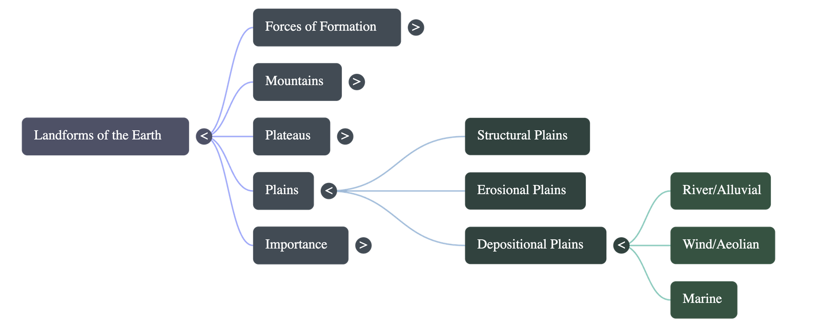
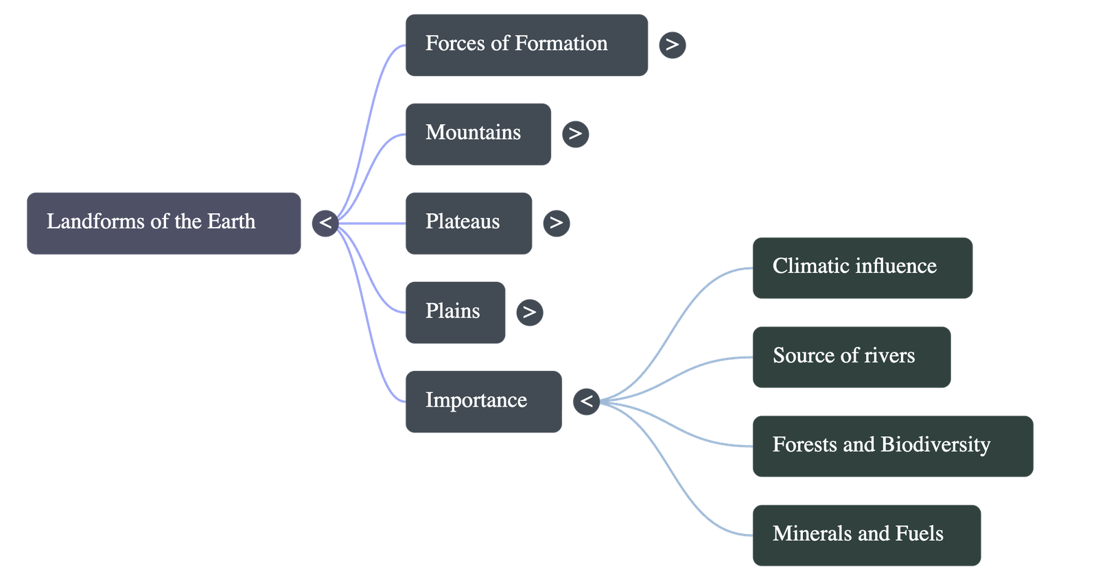
Landforms of the Earth
1. Introduction to Landforms
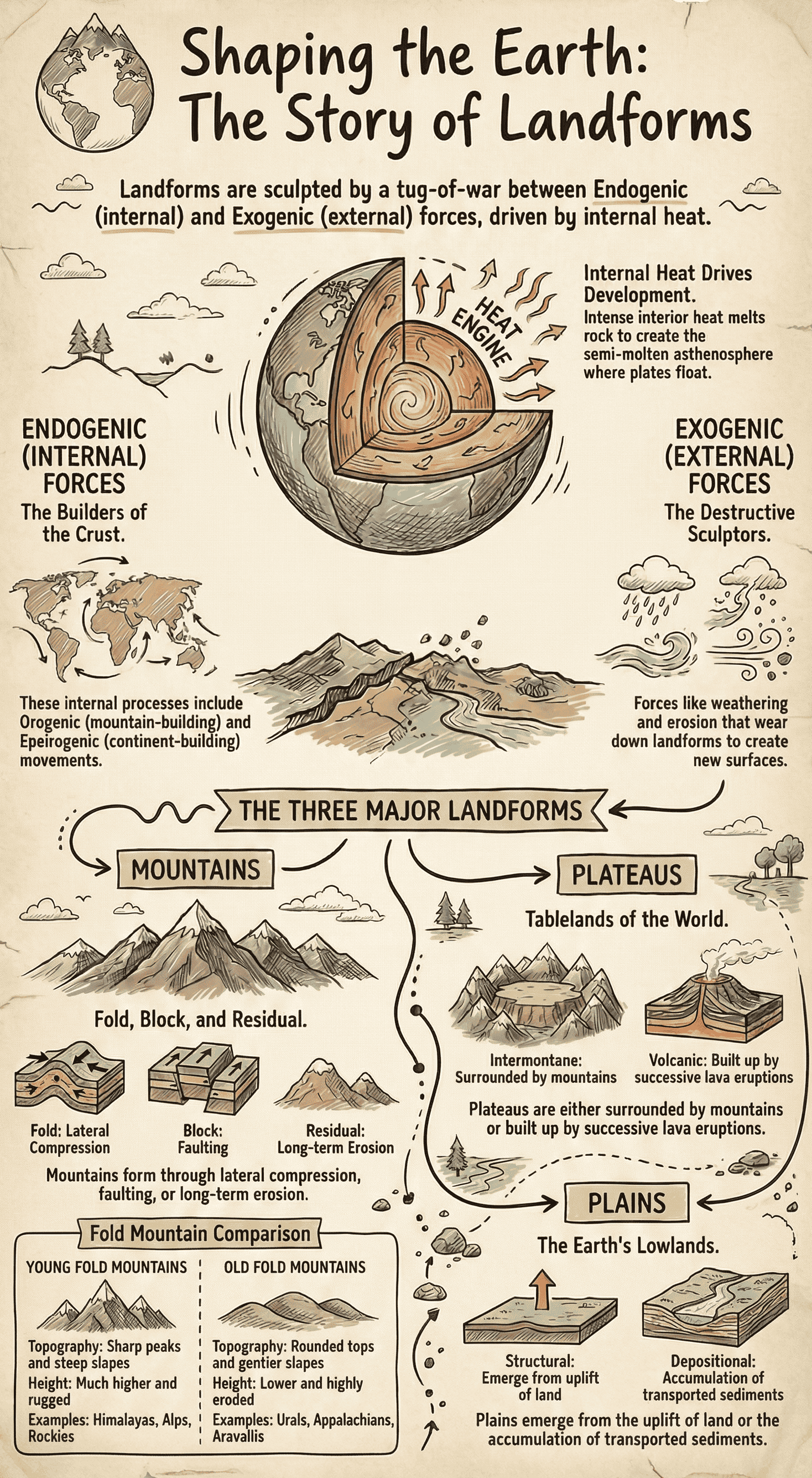
- The Earth consists of concentric rock layers: crust, mantle, and core.
- Intense internal heat melts rocks, keeping the asthenosphere (beneath the crust) in a semi-molten state, which leads to landform development.
- A landform is defined as a natural feature of the earth's surface.
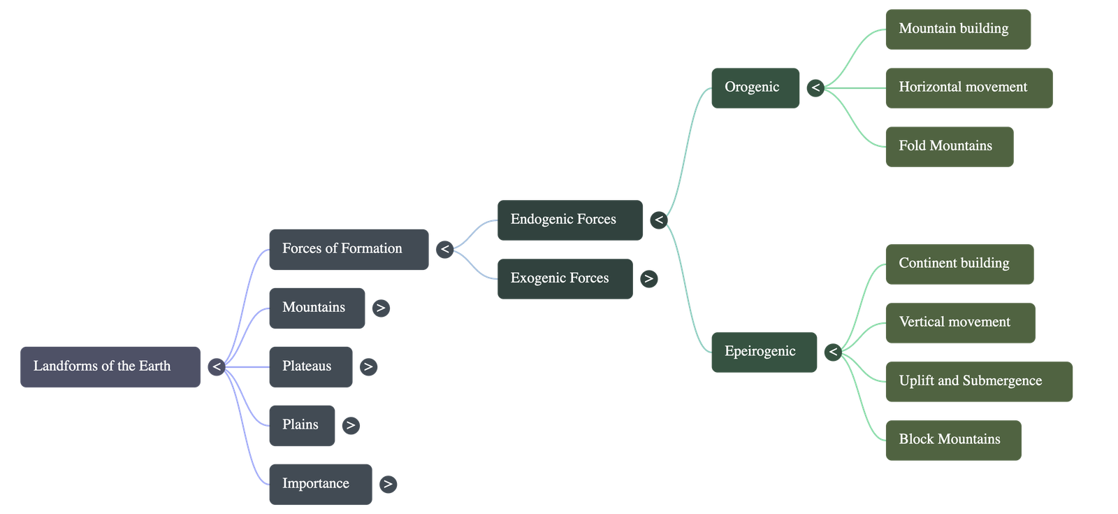
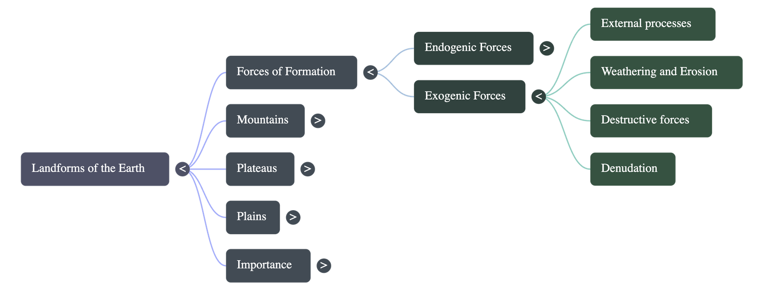
2. Causes of Landform Development
- Plate Tectonics (Orogenic Movements): The lithosphere is broken into plates that float on the semi-molten asthenosphere. Their horizontal movement (colliding, pushing, sliding) compresses sedimentary rocks, causing them to fold. These mountain-building forces act at a tangent to the surface.
- Uplift and Submergence (Epeirogenic Movements): Vertical movements acting along the Earth's radius cause large-scale uplift or subsidence of land (continent-building). This leads to faulting, block mountains, basins, and rift valleys.
- Note: Orogenic and Epeirogenic forces originate deep inside the earth and are together called Diastrophic Forces.
- Exogenic Forces: External forces operating on the surface. They are called "Destructive Forces" because they cause widespread weathering and erosion, creating new landforms through erosion and deposition.
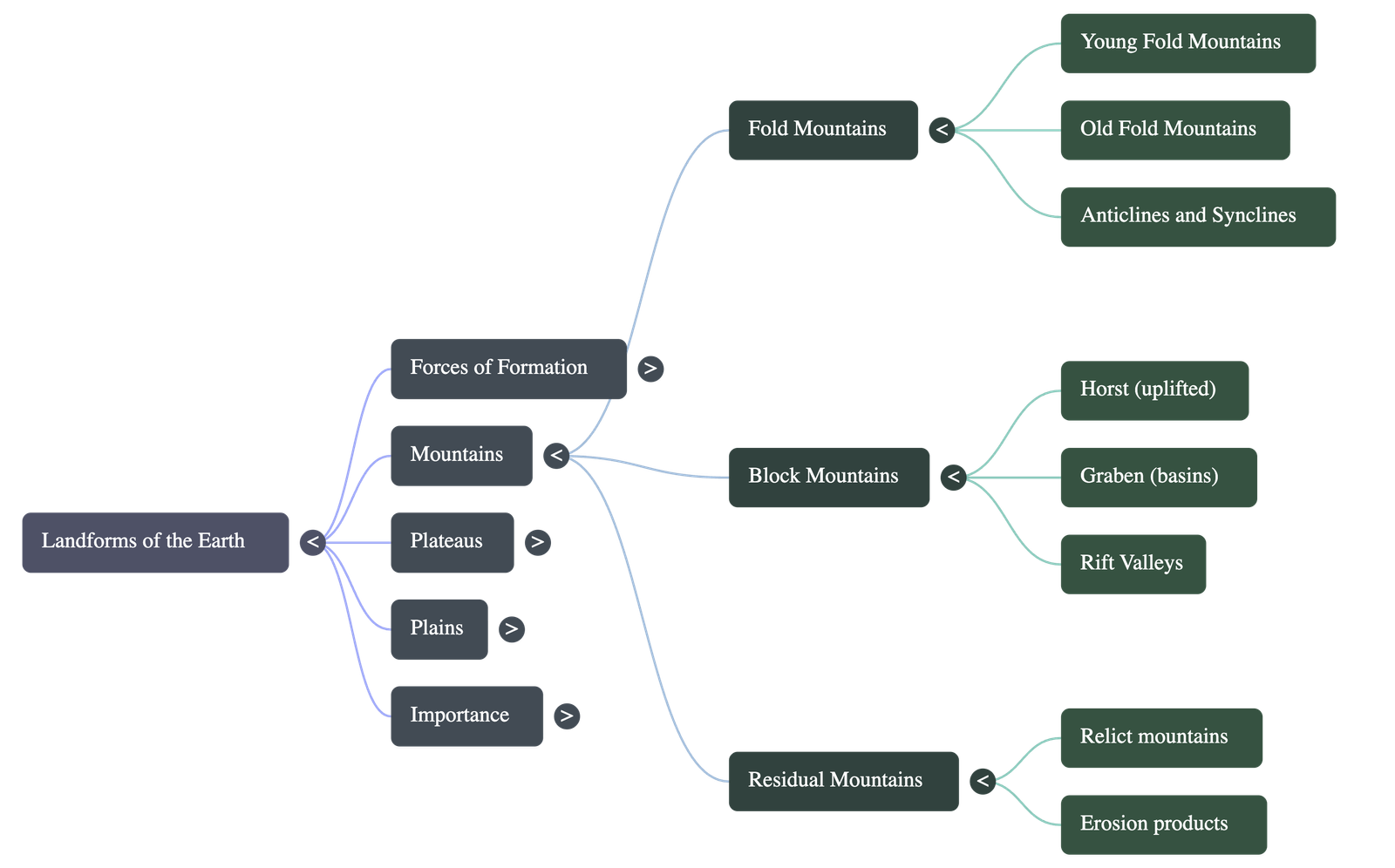
3. Major Landforms: Mountains
A mountain is a steep land or hill rising to great heights above the surrounding land. They are classified into three types based on formation:
A. Fold Mountains
- Formed by lateral compression and stresses in the earth's crust, producing wrinkles or folds along lines of weakness.
- They form irregular wave-like formations: upfolded arch-like shapes are anticlines (crests), and down-folded structures are synclines (troughs).
- Most are constituted of sedimentary rocks formed in shallow oceans (e.g., the Tethys Sea for the Himalayas).
- They are the highest and most extensive ranges, generally found on continental margins, facing oceans, and associated with volcanic activity.
- Old Fold Mountains: Formed long ago, highly eroded, gentle slopes, rounded tops (e.g., Appalachians, Urals, Aravallis).
- Young Fold Mountains: Formed later, much higher with steep slopes, deep valleys, and sharp snow-covered peaks (e.g., Himalayas, Andes, Alps, Rockies).
B. Residual Mountains
- Also known as relict mountains or mountains of denudation.
- Formed when existing mountains or plateaus are subjected to weathering and erosion by winds, water, and snow over a long time, wearing them down.
- Examples: Nilgiri, Parasnath, and Rajmahal Hills (India), Catskill range (USA).
C. Block Mountains
- Formed due to tensional forces causing cracks or faults in the crust.
- When land between parallel faults subsides, it forms a rift valley (e.g., African Rift Valley). When a block rises, it forms a horst or block mountain.
- Often have flattened summits or tilted summits (one side steep, the other gentle). They are separated by intervening basins called graben.
- Examples: Vosges (France), Black Forest (Europe), Salt Range (Pakistan), Sierra Nevada (USA).
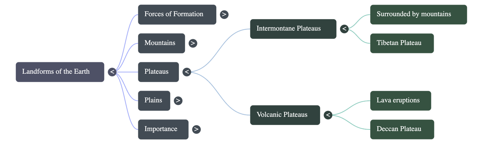
4. Major Landforms: Plateaus
A plateau is an area of high ground (500 feet above ground level) with a steep slope on one side and a generally flat upper part called a tableland.
- Intermontane Plateaus: The highest and most extensive types, surrounded by hills and mountains on all sides. Formed along with fold mountains. Examples: Tibetan Plateau (world's highest), Columbian, Bolivian, Peruvian.
- Volcanic Plateaus: Formed by numerous volcanic eruptions that slowly build up over time. Examples: Peninsular India (northwestern Deccan lava plateau), South African, Ethiopian, Columbian plateaus.
5. Major Landforms: Plains
Plains are extensive areas of lowland with a level or gently undulating surface.
- Structural Plains: Formed due to diastrophic forces causing uplift or subsidence of land. Examples: Great Plains of the USA (uplift of submerged land) and Coromandel plains in India (mild subsidence followed by sedimentation).
- Depositional Plains: Formed by the deposition of materials brought by various agents:
- River Deposition: Alluvial plains (Northern Plains of India), flood plains (Mississippi), deltaic plains (Egypt), and Piedmont plains at mountain foothills.
- Wind Deposition: Sandy deserts (Sahara, Thar) with undulating sand dunes, and Loess plains (China).
- Marine Deposition: Coastal regions, estuarine banks, and reclaimed land from the sea called polders (e.g., in the Netherlands and Denmark).
6. Importance of Landforms
- They are beautiful natural sculptures that add to the earth's aesthetic value.
- They impact climate, wind direction, and precipitation (e.g., the Himalayas act as a climatic divide).
- Mountains covered with snow and glaciers are vital sources of perennial rivers.
- Mountain slopes, hills, and plateaus support diverse forests, contributing heavily to Earth's biodiversity.
- Coastal landforms and island groups serve as ideal fishing sites.
- The interior disturbances that create major landforms bring valuable mineral and fossil fuels closer to the earth's surface.
Quick Navigation:
| | | |
1 / 1
Quick Navigation:
| | | |