Quick Navigation:
| | | |
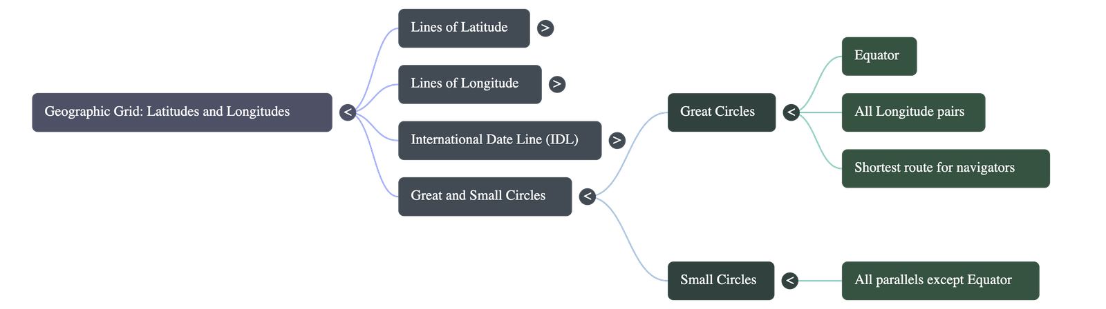
Geographic Grid: Latitudes and Longitudes
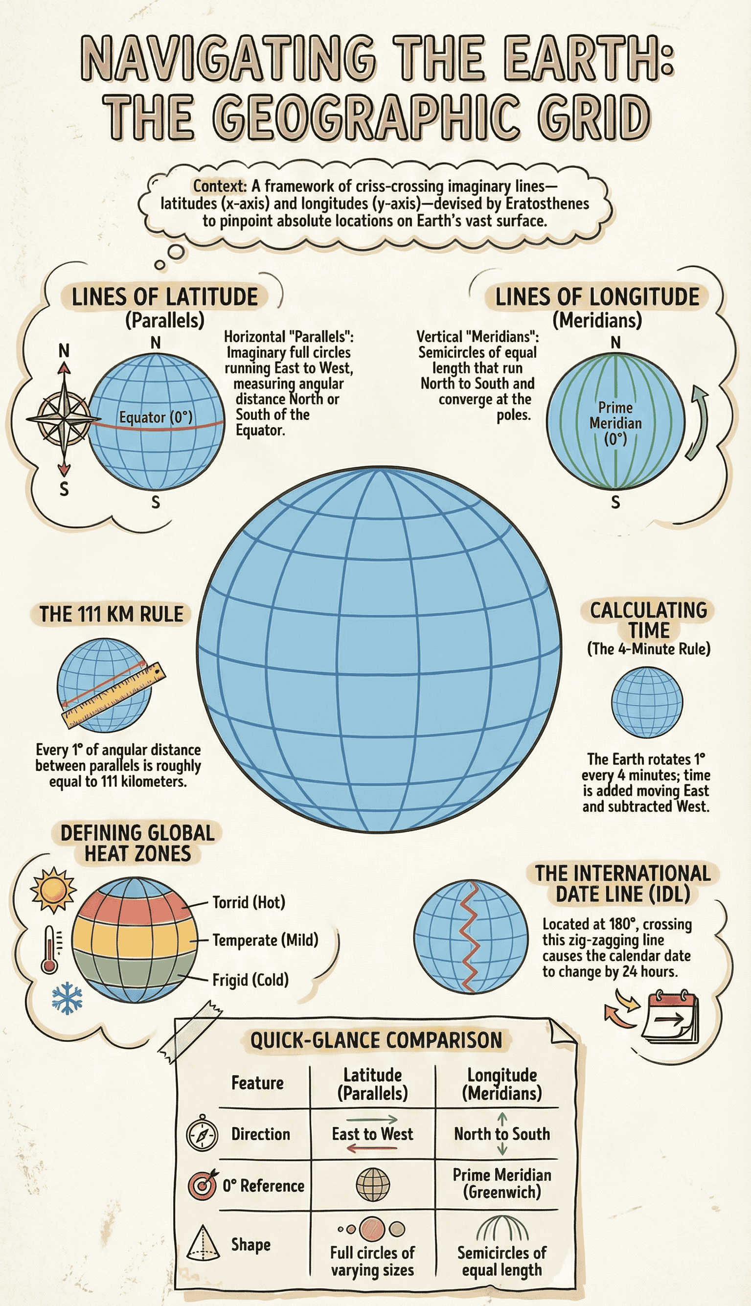
The Geographic Grid
- The Earth is vast, so an imaginary criss-crossing framework of lines called the Geographic Grid is used to pinpoint exact locations.
- Eratosthenes, a Greek philosopher, was the first to devise lines of latitude and longitude to locate places on Earth.
- This grid functions like the x-axis (latitudes) and y-axis (longitudes) coordinate system on graph paper.
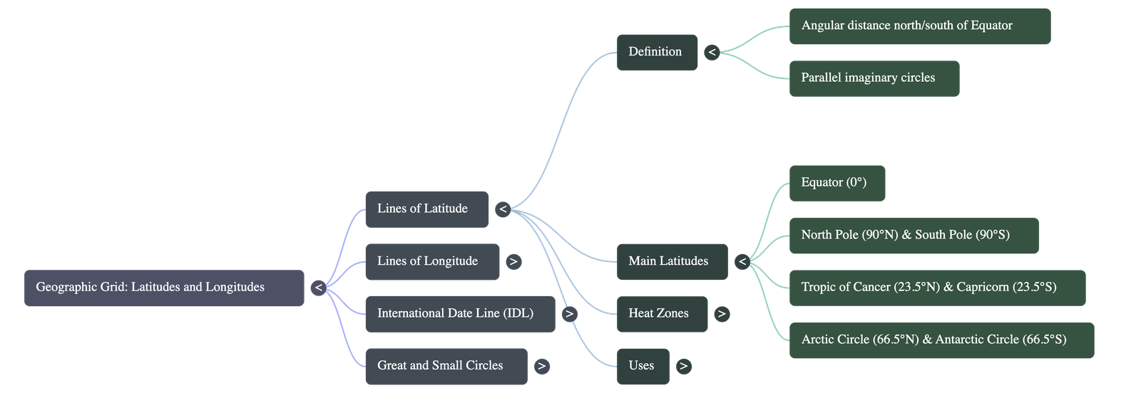
Lines of Latitude
- Latitudes are imaginary lines running east to west, parallel to the Equator. They are also known as "parallels of latitude".
- They measure the angular distance of a place north or south of the Equator.
- The Equator is the longest line of latitude (0°), dividing the Earth into the Northern and Southern Hemispheres.
- There are 181 parallels of latitude in total at 1° intervals.
- Latitudes decrease in length as they move towards the poles. At 60° latitude, the length is half of the Equator, and at the poles (90°N and 90°S), they are merely dots.
- Main Latitudes: Equator (0°), Tropic of Cancer (23½°N), Tropic of Capricorn (23½°S), Arctic Circle (66½°N), Antarctic Circle (66½°S), North Pole (90°N), and South Pole (90°S).
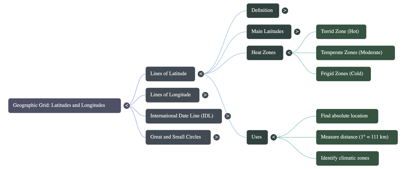
- Uses: They help find the absolute location of a place, measure north-south distances (1° of latitude is roughly 111 km), and divide the Earth into thermal/heat zones.
Heat Zones of the Earth
- Torrid or Tropical Zone: Located between the Tropic of Cancer and the Tropic of Capricorn. It is the hottest region of the Earth.
- Temperate Zones: Located between the Tropics and the Arctic/Antarctic Circles in both hemispheres. The climate here is moderate (neither too hot nor too cold).
- Frigid Zones: Polar regions located between the Arctic/Antarctic Circles and the Poles. These regions receive slanting sun rays and record very low temperatures.
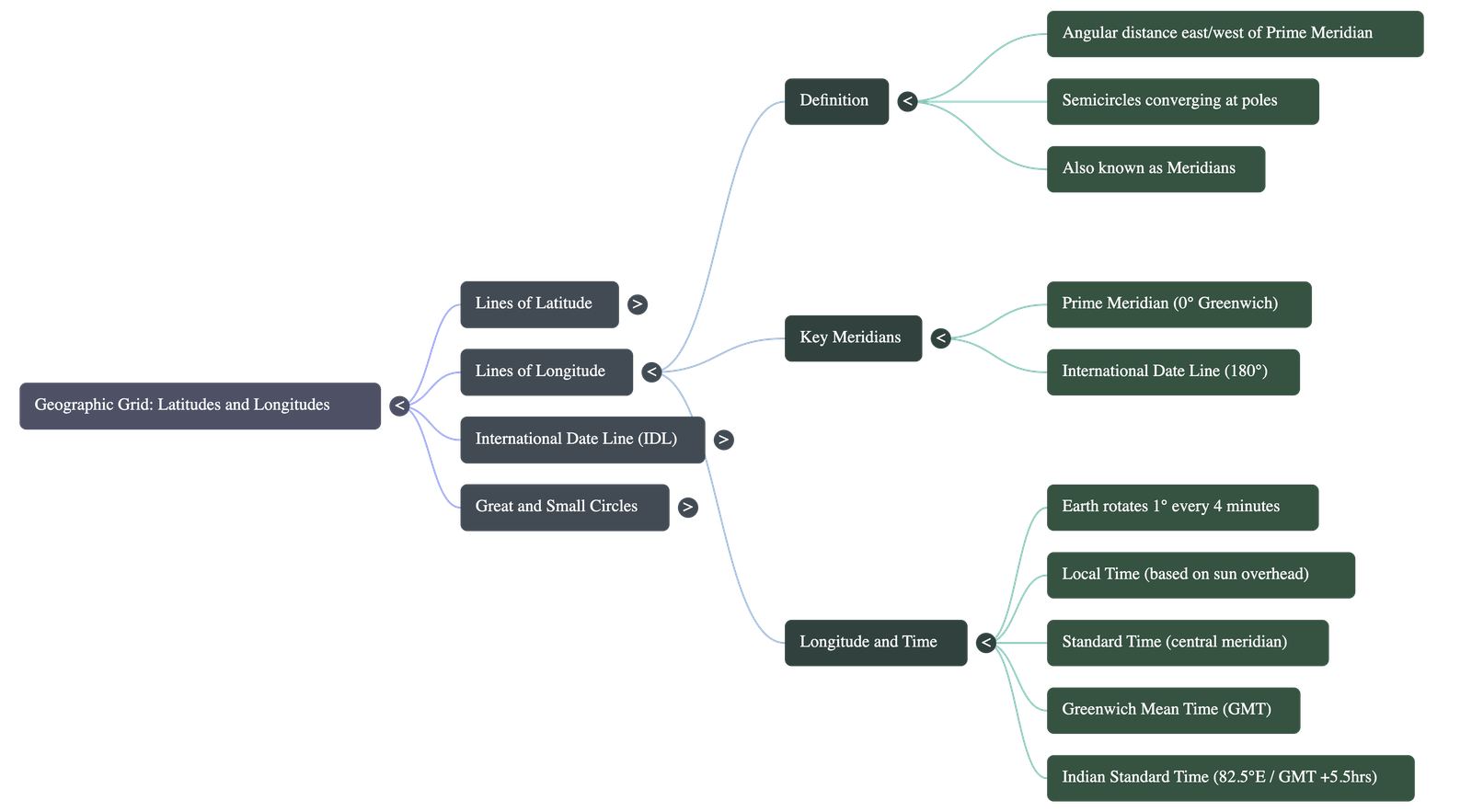
Lines of Longitude
- Longitudes are imaginary vertical lines running north to south and converging at the poles. They are also called "Meridians".
- They measure the angular distance east or west of the Prime Meridian.
- The Prime Meridian (0°) passes through Greenwich, near London.
- There are a total of 360 lines of longitude at 1° intervals. All lines of longitude are semicircles of equal length.
- The distance between longitudes is maximum at the Equator (111 km) and gradually decreases to 0° at the poles.
- Uses: Longitudes are primarily used to determine the local and standard time of a place.
Longitude and Time Calculation
- The Earth rotates 360° in 24 hours, meaning it covers 15° of longitude in one hour, or 1° in 4 minutes.
- Because the Earth rotates from West to East, places in the East see the sun first. Time is calculated using the EGA-WLS formula: East-Gain-Add and West-Lose-Subtract.
- Local Time: Time determined by the overhead sun at noon. Every place on a different longitude has its own local time. All places on the same meridian share the same local time.
- Time Zones: To avoid confusion, the Earth is divided into 24 Time Zones, each covering 15° of longitude. Large countries like Russia, Canada, and the USA have multiple time zones.
- Standard Time: A uniform time chosen for an entire region based on a central meridian.
- Greenwich Mean Time (GMT): The global reference time determined at the 0° longitude in Greenwich.
- Indian Standard Time (IST): Based on the central meridian of 82°30'E passing through Mirzapur. India's time is 5 hours and 30 minutes ahead of GMT.
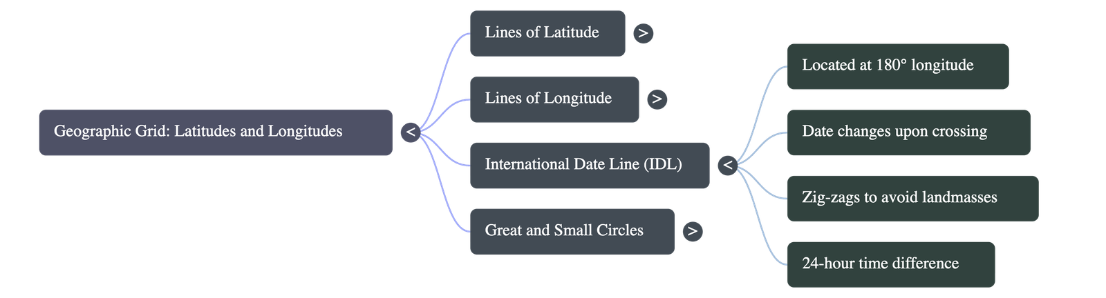
The International Date Line (IDL)
- The IDL is the 180° longitude line, diametrically opposite to the Prime Meridian.
- Crossing this line causes a full day's time difference (24 hours). A day is gained or lost depending on the direction of travel.
- The line goes zig-zag around certain places (like the Bering Strait, Fiji, Tonga, and New Zealand) to prevent different dates existing within the same country or island group.
Great and Small Circles
- Great Circle: A theoretical circle drawn on the Earth's surface with a radius equal to the Earth's radius, dividing the Earth into two equal halves.
- The Equator is the only latitude that is a great circle. However, every single line of longitude forms half of a great circle, and two opposite longitudes form a complete Great Circle.
- Small Circles: Circles that do not pass through the center of the Earth. All parallels of latitude (except the Equator) are small circles.
- Uses: Great circles provide the absolute shortest distance between two points on the globe. Navigators use Great Circle Routes to save time, ignoring standard weather/political routing where possible, and meteorologists use them to determine regional climate conditions.
Do checkout all questions & answers of this chapter.
Quick Navigation:
| | | |
1 / 1
Quick Navigation:
| | | |