Quick Navigation:
| | |
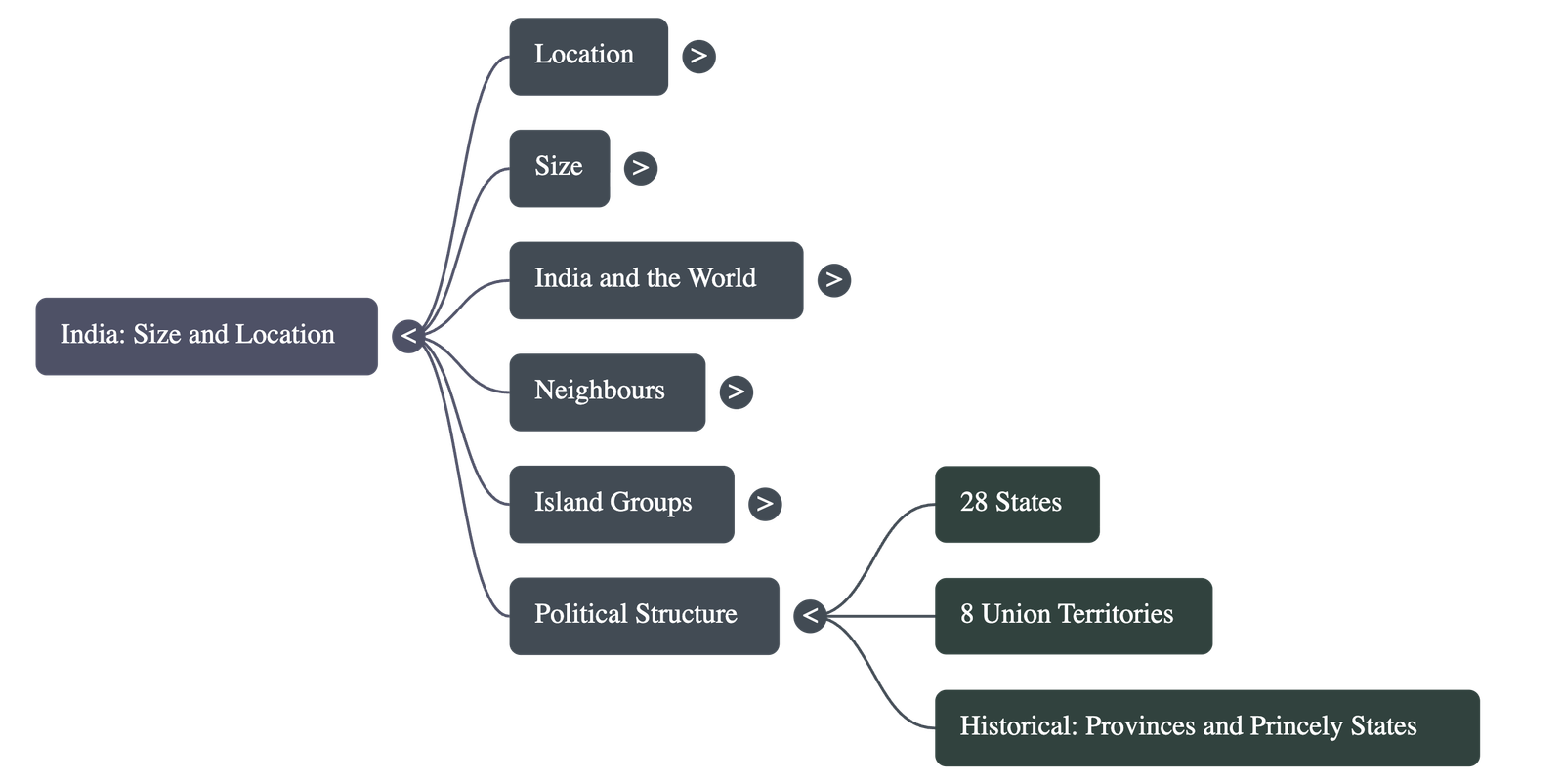
INDIA – SIZE AND LOCATION
Location and Setting
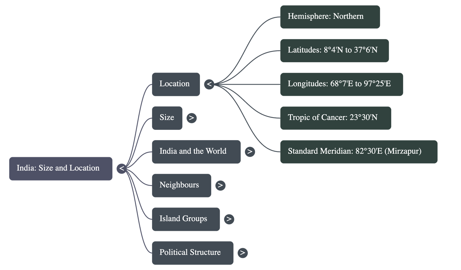
- Hemisphere: India lies entirely in the Northern Hemisphere.
- Latitudinal Extent: The mainland extends between latitudes 8°4'N and 37°6'N.
- Longitudinal Extent: The longitudes range from 68°7'E to 97°25'E.
- Tropic of Cancer: The Tropic of Cancer (23° 30'N) divides the country into almost two equal parts.
- Island Groups:
- The Andaman and Nicobar Islands lie to the southeast in the Bay of Bengal.
- The Lakshadweep Islands lie to the southwest in the Arabian Sea.
- Southernmost Point: Indira Point (part of the Indian Union) was submerged under seawater during the 2004 Tsunami.
Size and Dimensions
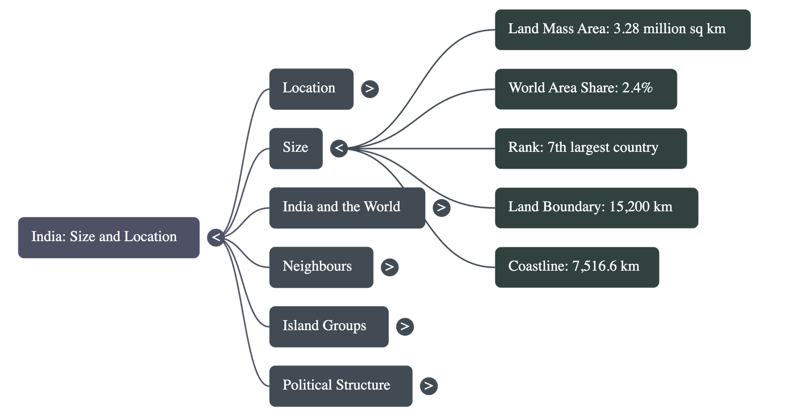
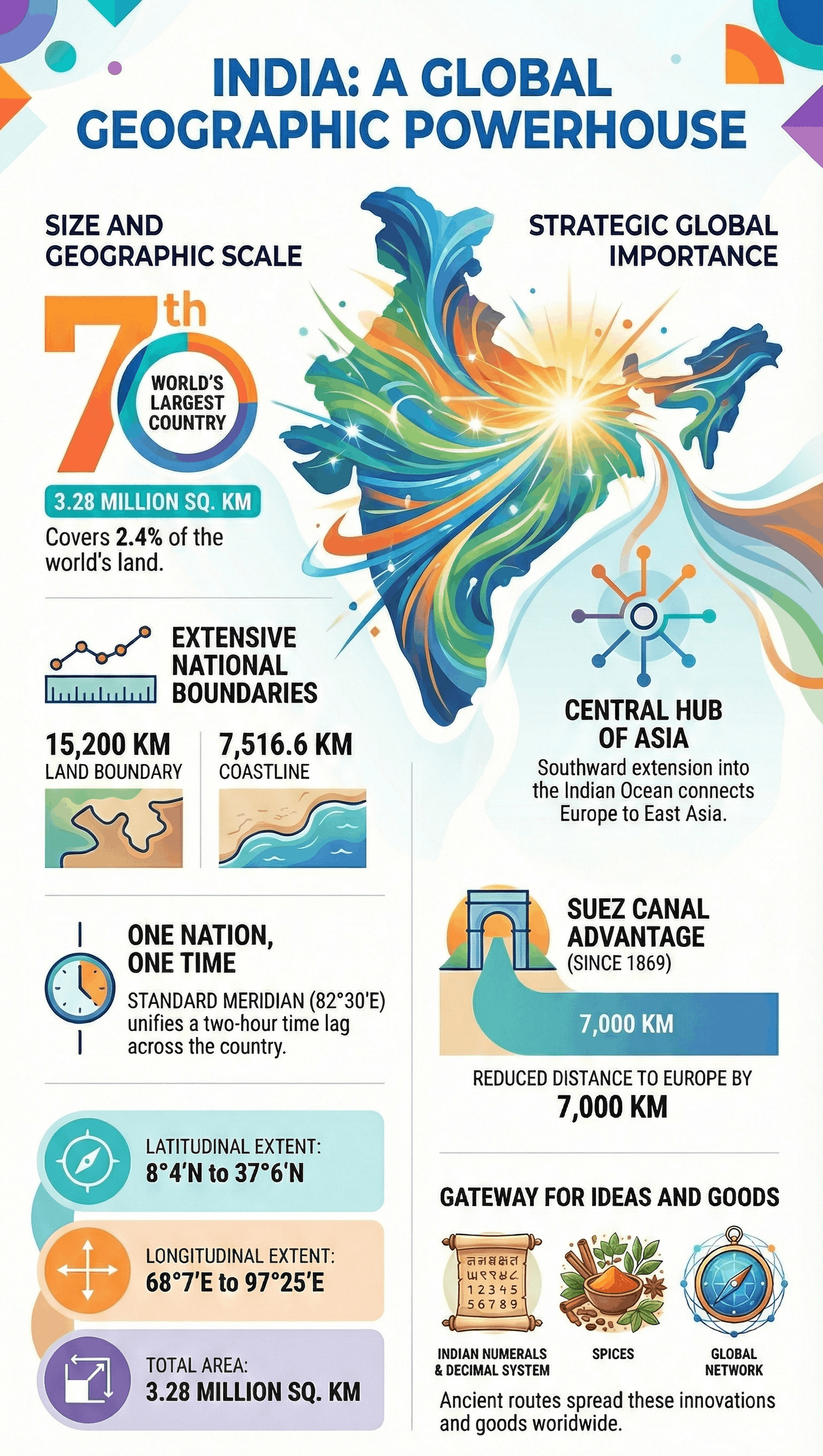
- Total Area: The landmass of India has an area of 3.28 million square km.
- Global Share: India accounts for about 2.4% of the total geographical area of the world.
- Global Ranking: India is the seventh largest country in the world.
- Land Boundary: Approximately 15,200 km.
- Coastline: The total length of the coastline (including Andaman and Nicobar and Lakshadweep) is 7,516.6 km.
- Physical Boundaries: Bounded by young fold mountains in the northwest, north, and northeast. South of 22°N latitude, the land tapers towards the Indian Ocean.
Time and Standard Meridian
- Geographical Extent: Both the latitudinal and longitudinal extent of the mainland are approximately 30°. Despite this, the east-west extent appears smaller than the north-south extent.
- Time Lag: There is a time lag of two hours between Gujarat (West) and Arunachal Pradesh (East).
- Standard Time: Time along the Standard Meridian of India (82°30'E), passing through Mirzapur (Uttar Pradesh), is taken as the standard time for the whole country.
- Day and Night: The latitudinal extent influences the duration of day and night as one moves from south to north (e.g., the difference is hardly felt in Kanniyakumari but is distinct in Kashmir).
India and the World
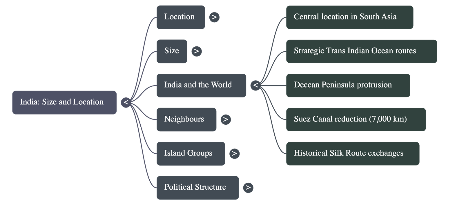
- Strategic Location: India has a central location between East and West Asia and is a southward extension of the Asian continent.
- Trade Routes: The Trans-Indian Ocean routes connect Europe in the West and East Asia, providing a strategic central location.
- The Deccan Peninsula: Protrudes into the Indian Ocean, helping establish contact with West Asia, Africa, and Europe from the western coast and with Southeast and East Asia from the eastern coast.
- Ocean Name: No other country has as long a coastline on the Indian Ocean as India, justifying the naming of the ocean after it.
- Suez Canal: Its opening in 1869 reduced India’s distance from Europe by 7,000 km.
- Cultural Exchange:
- Land routes are older than maritime contacts.
- These routes facilitated the exchange of ideas (Upanishads, Ramayana, Panchtantra, Indian numerals, decimal system) and commodities (spices, muslin) to the world.
- Conversely, Greek sculpture and West Asian architectural styles (domes and minarets) have influenced Indian architecture.
India’s Neighbors
- Administrative Divisions: India comprises 28 States and 8 Union Territories.
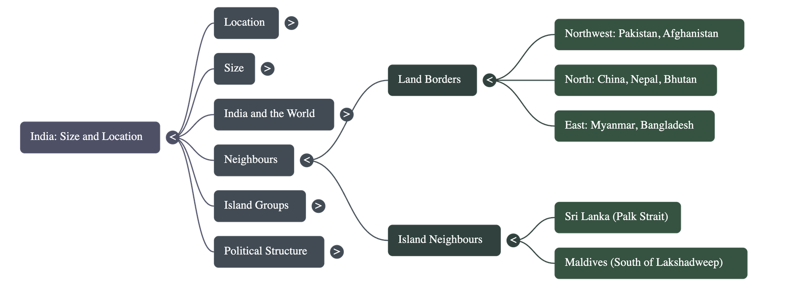
- Land Borders:
- Northwest: Pakistan and Afghanistan.
- North: China (Tibet), Nepal, and Bhutan.
- East: Myanmar and Bangladesh.
- Southern Neighbors (Island Countries):
- Sri Lanka: Separated from India by a narrow channel of sea formed by the Palk Strait and the Gulf of Mannar.
- Maldives: Situated to the south of the Lakshadweep Islands.
- Historical Context: Before 1947, India had "Provinces" (ruled by British officials) and "Princely States" (ruled by local hereditary rulers).
Quick Navigation:
| | |
1 / 1
Quick Navigation:
| | |