Quick Navigation:
| | | |
Map Of India
Chapter Syllabus Overview
This chapter focuses on the practical outline map of India, requiring students to locate, mark, and name key geographical features including mountains, peaks, plateaus, plains, deserts, rivers, water bodies, passes, latitudes, longitudes, direction of winds, mineral distribution, soil distribution, major cities, and population density.
1. Mountains, Peaks, Passes, and Plateaus
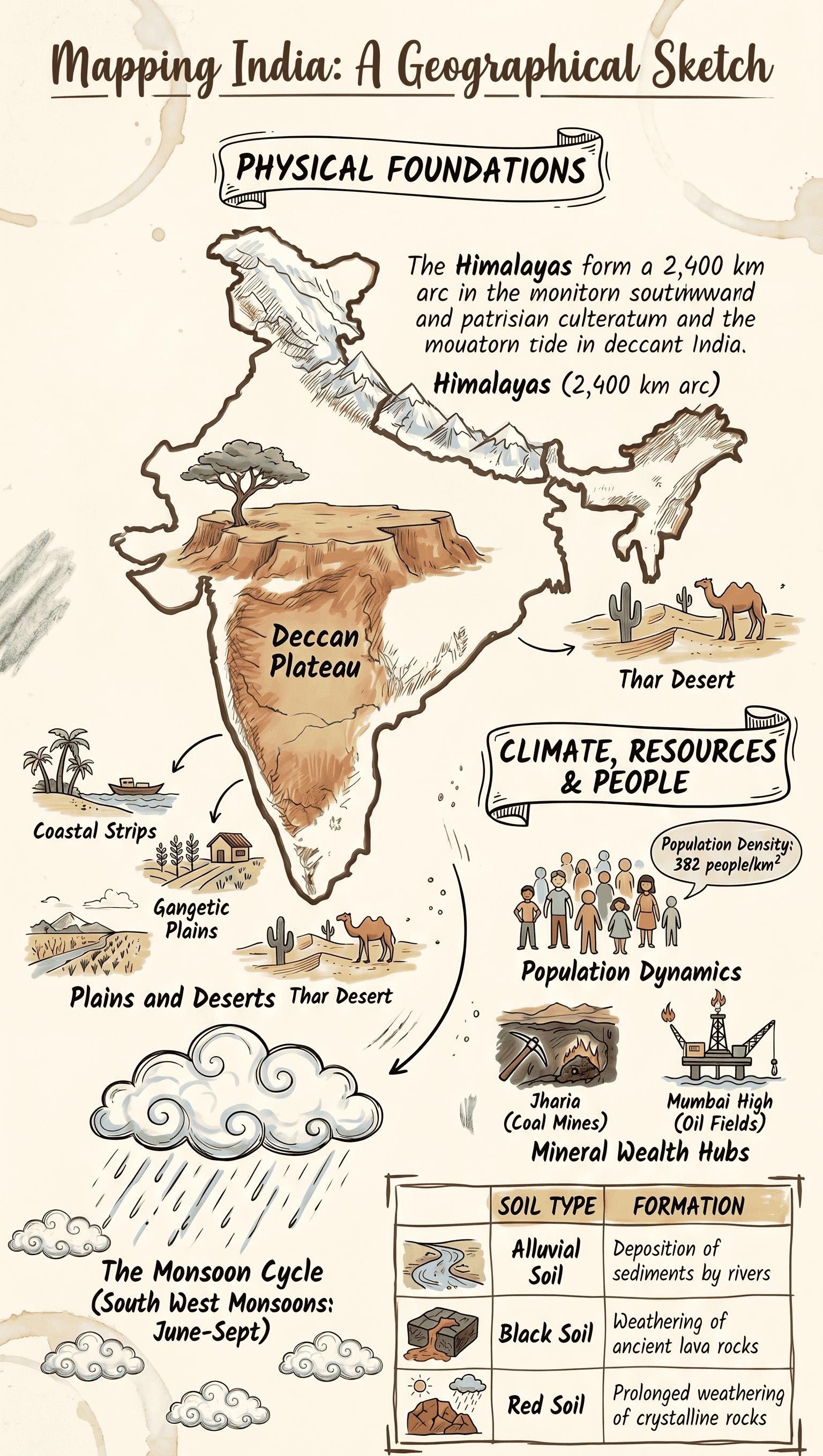
- The Himalayas: These form an enormous arc covering a distance of about 2,400 km. They run in a west-to-east direction from the river Indus to the Brahmaputra.
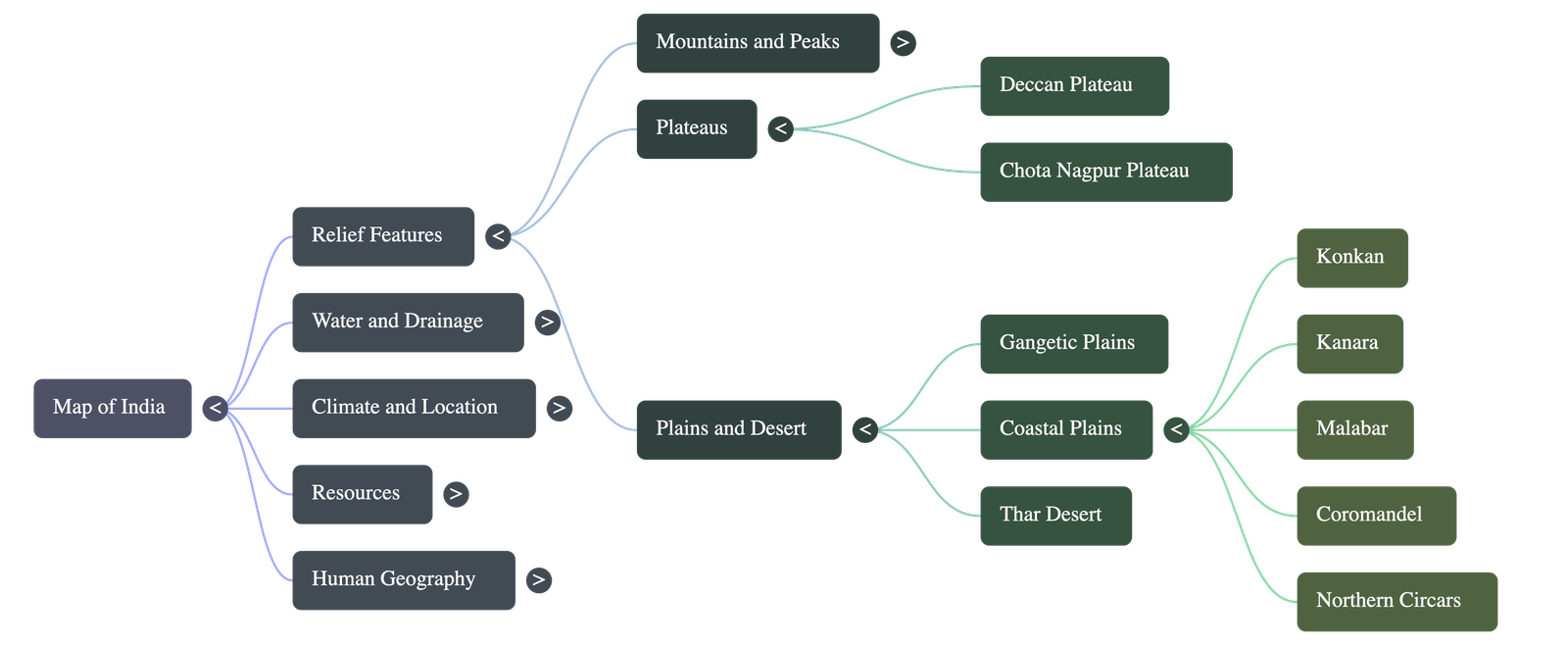
- Deccan Plateau: A large triangular landmass that lies directly to the south of the river Narmada.
- Chota Nagpur Plateau: An eastern plateau region that is highly rich in mineral resources.
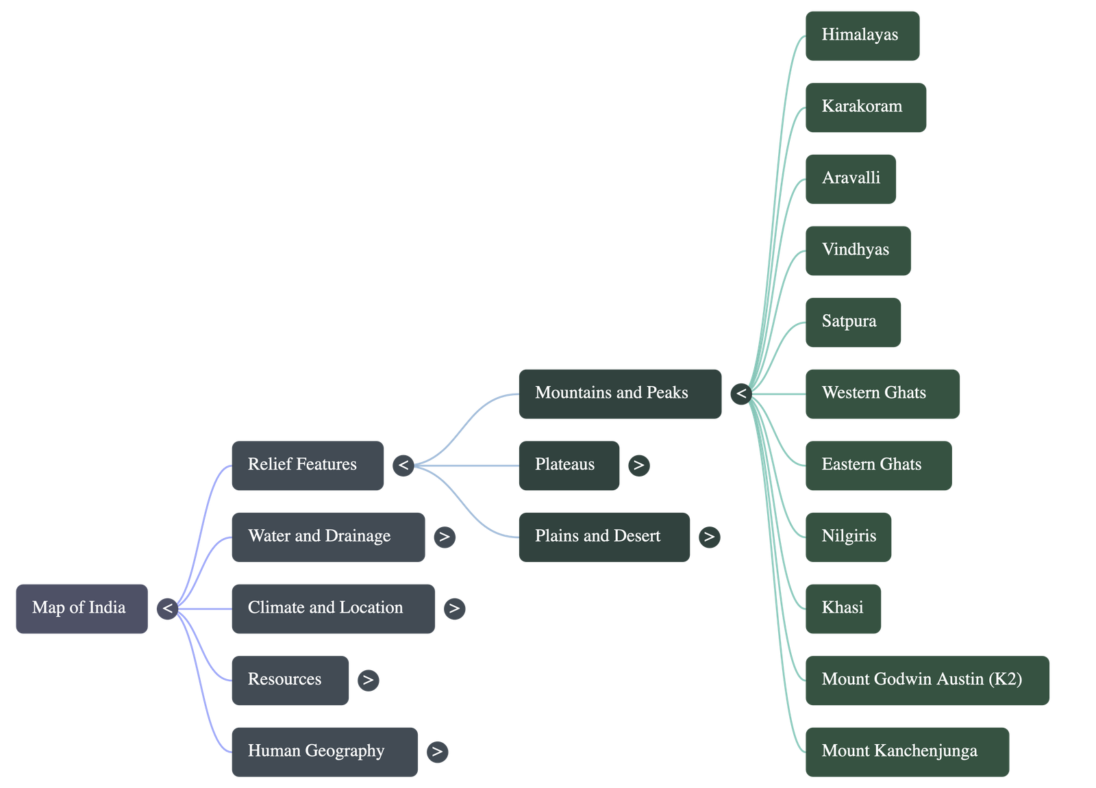
- Other Key Ranges & Peaks: Includes Karakoram, Aravalli, Vindhya, Satpura, Western and Eastern Ghats, and Nilgiris. Major peaks include Mount Godwin Austin (K2), Mount Kanchenjunga, and Nanda Devi.
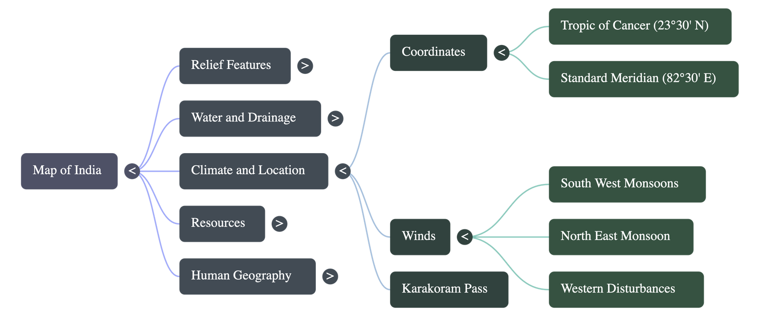
- Passes: Karakoram Pass is a prominent mountain pass marked in the northern region.
2. Plains and Desert
- Gangetic Plains: These vast plains are spread over the northern Indian states, specifically Haryana, Delhi, Uttar Pradesh, Bihar, and parts of Jharkhand and West Bengal.
- Western Coastal Plains: Stretching from the Arabian Sea to the Western Ghats, this coast is divided into three parts: the northern stretch is the Konkan, the central stretch is the Kanara, and the southern part is the Malabar coast.
- Eastern Coastal Plains: Located between the Bay of Bengal and the Eastern Ghats. Its northern part is called the Northern Circars, and the southern part is the Coromandel Coast.
- The Desert: The Thar Desert (The Great Indian Desert) is located in the north-western part of the country.
3. Rivers and Water Bodies
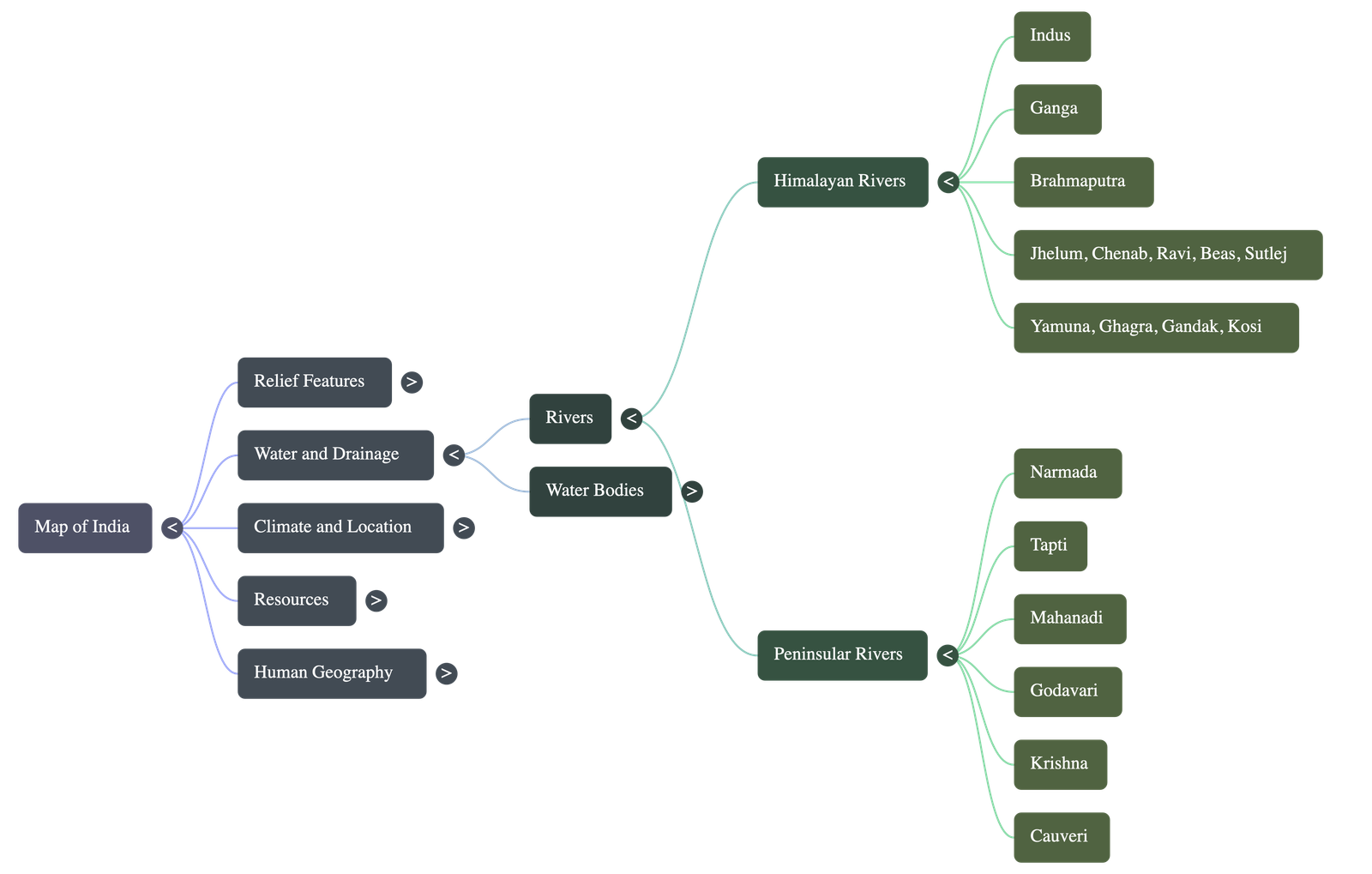
- River Classifications: Indian rivers are broadly divided into two groups:
- Himalayan Rivers: Indus, Ganga, and Brahmaputra along with their tributaries.
- Peninsular Rivers: Narmada, Tapti, Godavari, Krishna, Mahanadi, Cauveri, and other smaller rivers.
- Rivers of Sorrow: Large catchment areas and seasonal monsoon rains lead to heavy flooding. The river Kosi is known as the 'Sorrow of Bihar', while the river Damodar is known as the 'Sorrow of Bengal'.
- Gulfs and Straits:
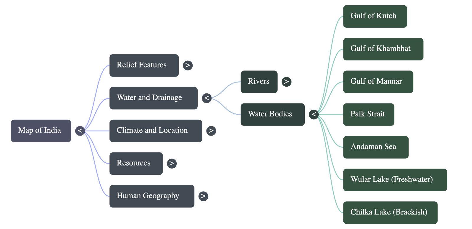
- A Gulf is a large area of sea partially enclosed by land (e.g., Gulf of Kutch, Gulf of Khambhat, Gulf of Mannar).
- A Strait is a narrow channel of water lying between two landmasses. The Palk Strait is located between Tamil Nadu and Sri Lanka.
- Important Lakes: Chilka Lake is the largest salt water (brackish) lake in India. Wular Lake is a prominent fresh water lake situated in the Bandipora district of Jammu and Kashmir.
4. Latitude and Longitude
- Tropic of Cancer (23°30' N): This latitude divides the country into almost two equal halves and marks the northernmost limit of the sun’s apparent motion.
- Standard Meridian of India (82°30' E): This longitude passes through Mirzapur near Prayagraj (Allahabad) in Uttar Pradesh. It is used to determine the Indian Standard Time (IST), which is exactly 5½ hours ahead of Greenwich Mean Time (GMT).
5. Direction of Monsoon Winds
- South West Monsoon (Advancing Monsoon): These summer monsoon winds blow from the south-west direction. They bring widespread rains to the country from June to September.
- North East Monsoon (Winter Monsoon): These winter monsoon winds blow from the north-east. Interestingly, the Southern Coromandel Coast (in Tamil Nadu) receives its rainfall primarily from these winter monsoons.
- Western Disturbances: These are low-pressure systems that originate far away in West Asia and regions near the Mediterranean Sea. They reach India during winter, bringing much-needed winter rainfall over the plains and snowfall in the mountainous regions.
6. Distribution of Minerals
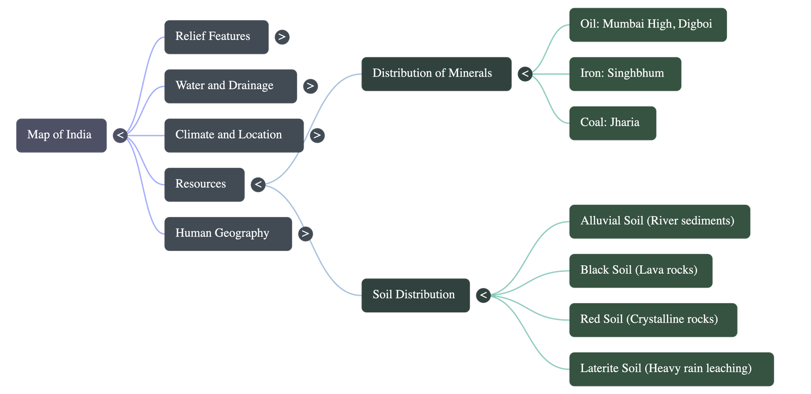
- Coal: The Jharia coal mines, a major source of coal, are located in the state of Jharkhand.
- Oilfields:
- Mumbai High: An offshore oil field located in the Arabian Sea, 176 km north-west of Mumbai.
- Digboi: Located in Assam, it is the oldest oil field in India, operating since 1866.
7. Soil Distribution
- Laterite Soil: Formed as a result of intense leaching in areas that experience heavy rainfall.
- Red Soil: Formed by the prolonged weathering of crystalline rocks.
- Black Soil: Created by the weathering of volcanic lava rocks over time.
- Alluvial Soil: The most fertile soil, formed by the continuous deposition of sediments carried by rivers.
8. Cities
- Urban Demographics: According to the Census of 2011, 27.8 percent of India's urban population lives in more than 5,100 towns and over 380 urban agglomerations.
- City Classifications: Cities are classified by population size:
- Megacity: Population greater than 5,000,000.
- Metropolis: Population between 1,000,000 and 4,999,999.
- Sub-Metropolis: Population between 500,000 and 999,999.
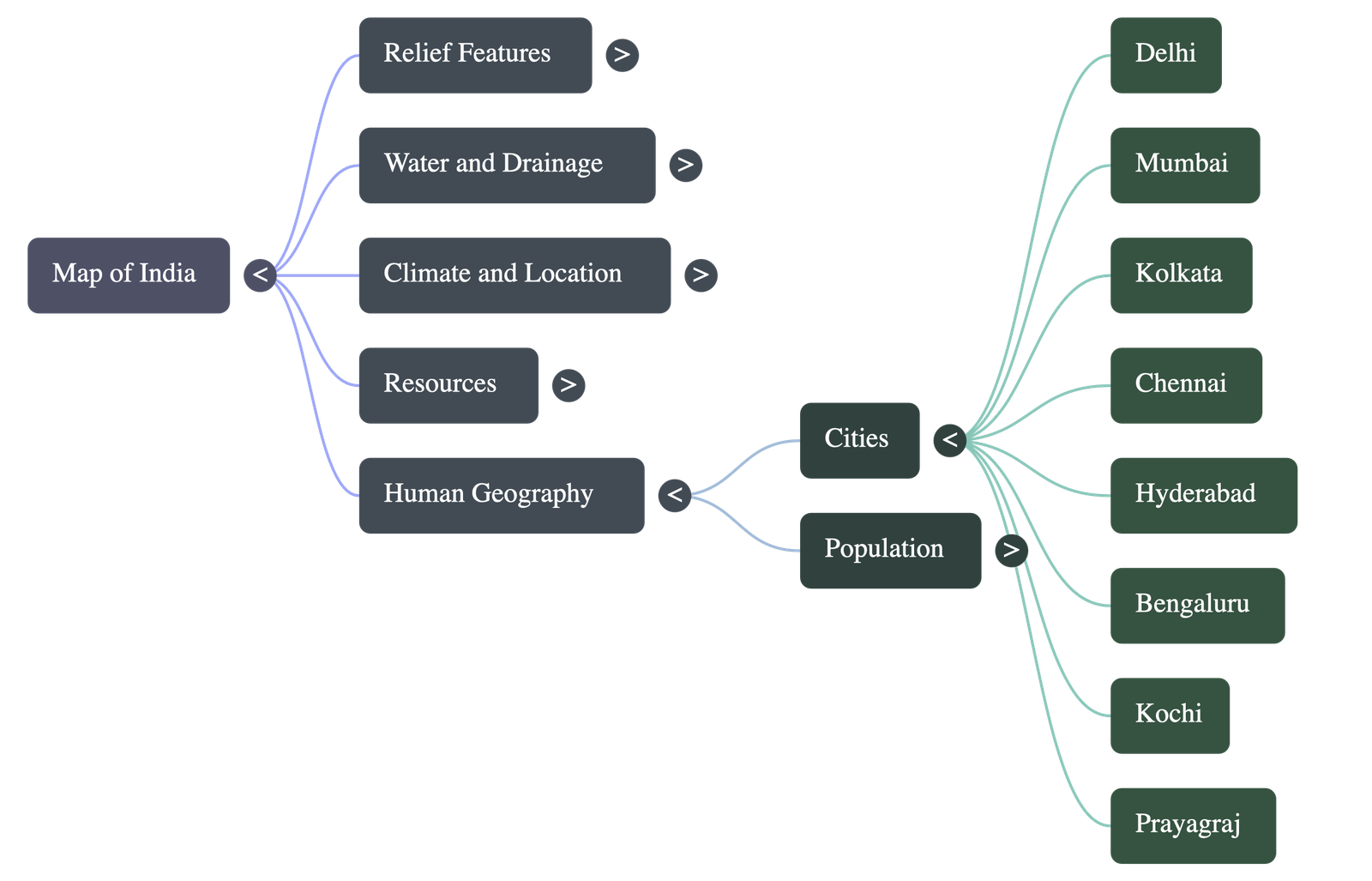
- Major Cities to Map: Delhi, Mumbai, Kolkata, Chennai, Hyderabad, Bengaluru, Kochi, and Prayagraj (Allahabad).
9. Distribution of Population
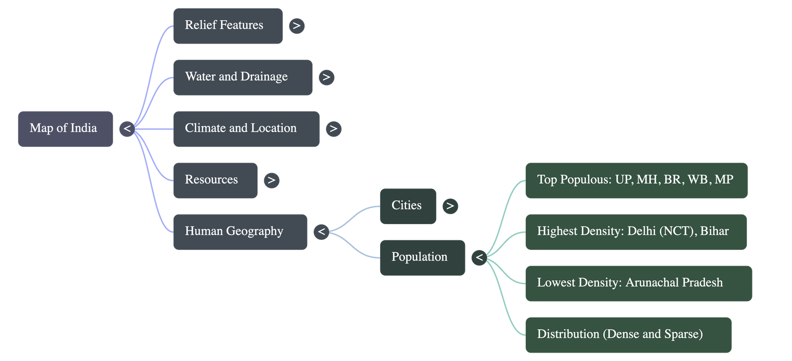
- Top Populous States: The five states with the highest population are Uttar Pradesh, Maharashtra, Bihar, West Bengal, and Madhya Pradesh.
- Population Density Concept: Density is calculated as the total number of persons living per unit area.
- Density Extremes (2011 Census):
- Highest Overall Density: National Capital Territory of Delhi (NCT) with a staggering 11,297 persons per unit area.
- Lowest Overall Density: Arunachal Pradesh.
- State-Level Density: Among regular states, Bihar has the highest population density (1102), followed by West Bengal (1029), and Kerala (859).
10. Exercises and Map Practice
- The concluding section of the chapter provides numerous outline maps of India intended as practical exercises for students.
- These exercises require the student to actively shade, mark, name, and label the geographical features discussed throughout the chapter (e.g., shading the region of black soil, marking the Karakoram Pass, labeling the river Narmada, and pointing out the winds that bring rain to the Coromandel Coast in winter).
Summary prepared for Class 10 Geography Revision.
Do checkout all questions & answers of this chapter.
Quick Navigation:
| | | |
1 / 1
Quick Navigation:
| | | |