Quick Navigation:
| | | |
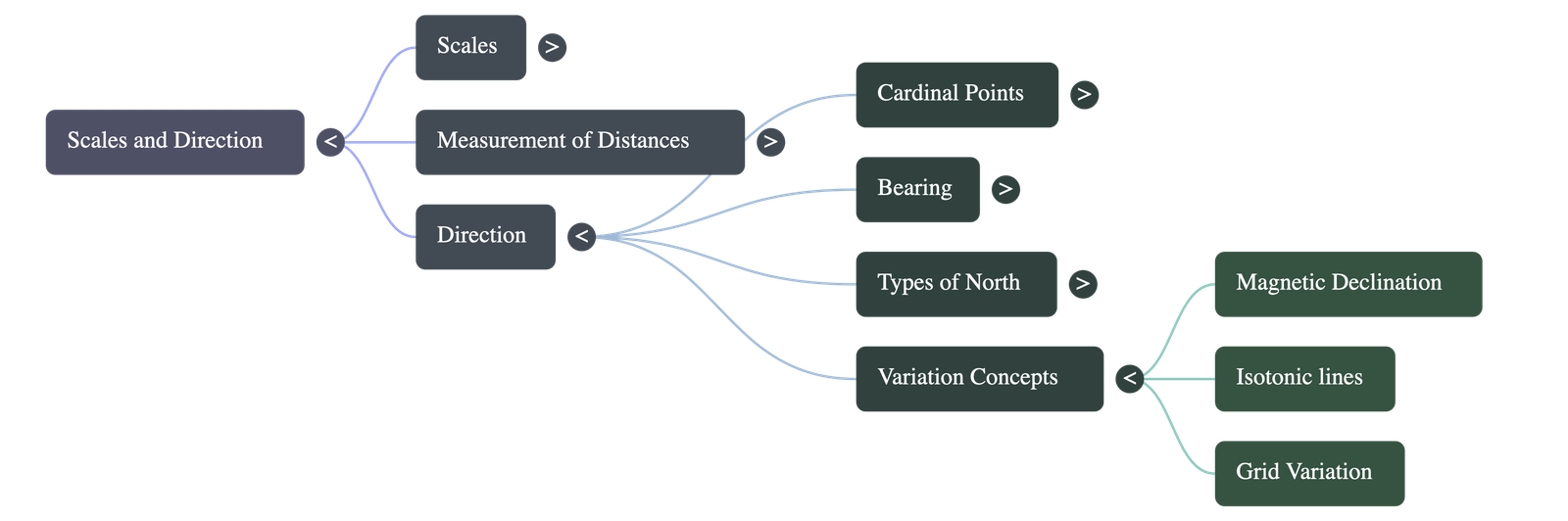
Scales and Direction
1. Understanding Scales
- A map represents the features of the earth's surface in a miniature form. Therefore, maps must be drawn to scale to accurately depict these features.
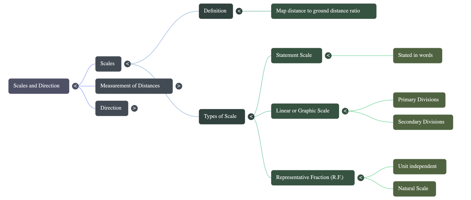
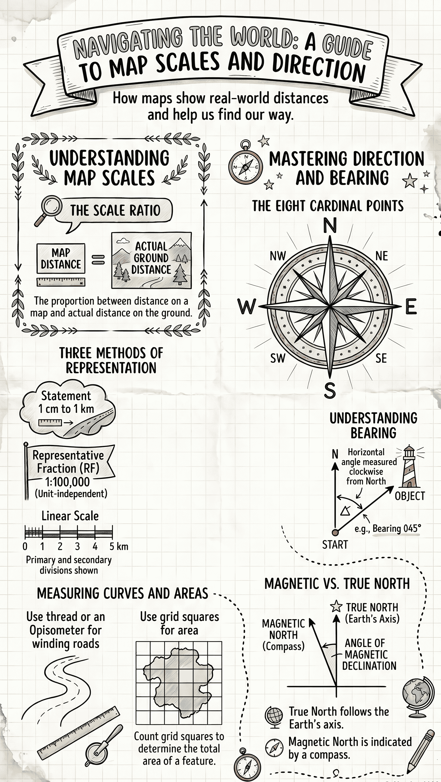
- Definition: The scale of a map denotes the proportion (or ratio) between the distance of any two points on the map and the actual distance between those same two points on the ground.
- Formula: Scale = Map distance between two points / Ground distance between the same points.
2. Types of Scale
There are three main methods of representing the scale on a map:
(i) A Statement (Verbal Scale)
- The scale is stated in words (e.g., "1 cm to 1 km" or "1 inch to 5 miles").
- The left-hand value represents the map distance, and the right-hand value represents the ground distance.
- Drawback: It requires knowledge of the specific units of measurement used. Also, if the map is reduced or enlarged from its original size, the statement scale becomes invalid.
(ii) Linear or Graphic Scale
- Represented by a straight line divided into equal parts to show what these markings represent on the actual ground.
- Divided into Primary Divisions (major divisions reading from left to right from zero) and Secondary Divisions (smaller units reading from right to left from zero).
- Advantage: It is the preferred method because it combines both a verbal statement and Representative Fraction (R.F.). Most importantly, it remains accurate even if the map is enlarged or reduced.
(iii) Representative Fraction (R.F.)
- Represented as a ratio of map distance to ground distance in the same units.
- The numerator is always expressed as unity (i.e., 1). For example, R.F. 1:100,000 means 1 unit on the map represents 100,000 identical units on the ground.
- Advantage: It is just a fraction and is entirely independent of any particular unit of measurement (cm, inches, etc.). It has universal application and is therefore known as an International Scale or Natural Scale.
3. Measurement of Distances on a Map
(a) Measuring Straight Lines
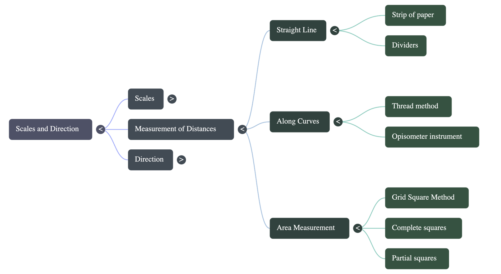
- Strip of Paper Method: Place the straight edge of a paper strip along the line. Mark the start and end limits with a sharp pencil. Finally, place the marked strip against the map's linear scale to read the exact distance.
- Divider Method: A pair of dividers can also be used to span the points and then placed against the linear scale to measure the distance.
(b) Measuring Curved Lines (Rivers, Winding Roads)
- Thread Method: Place a thread carefully along the curving course of a river or road. Measure the length of the used thread against the linear scale to find the actual ground distance.
- Opisometer: A small instrument with a spiked wheel used to measure curved surfaces. You roll it slowly along the curve, and the wheel's revolutions are recorded either manually or on a calibrated dial to determine the distance.
4. Area by the Grid Square Method
- On topographical maps, each grid square typically measures 2 cm × 2 cm. Since 2 cm equals 1 km (on standard topographical scales), the area of each full square is exactly 1 sq. km.
- Steps to Calculate Area:
- Count the number of completely filled grid squares within the required area.
- Count the incomplete squares based on specific approximation rules:
- Exactly half squares are counted as ½ squares.
- Squares that are more than half covered are counted as ⅔ squares.
- Squares that are less than half covered are counted as ⅓ squares.
- Add the values of all complete and incomplete squares together to get the total approximate area in square kilometers.
5. Direction
- Direction is a relative term essential for locating places on a map.
- The Earth rotates on its axis. The northern end of this axis is the North Pole and the southern end is the South Pole.
- Lines forming right angles to the North-South line indicate the East-West direction.
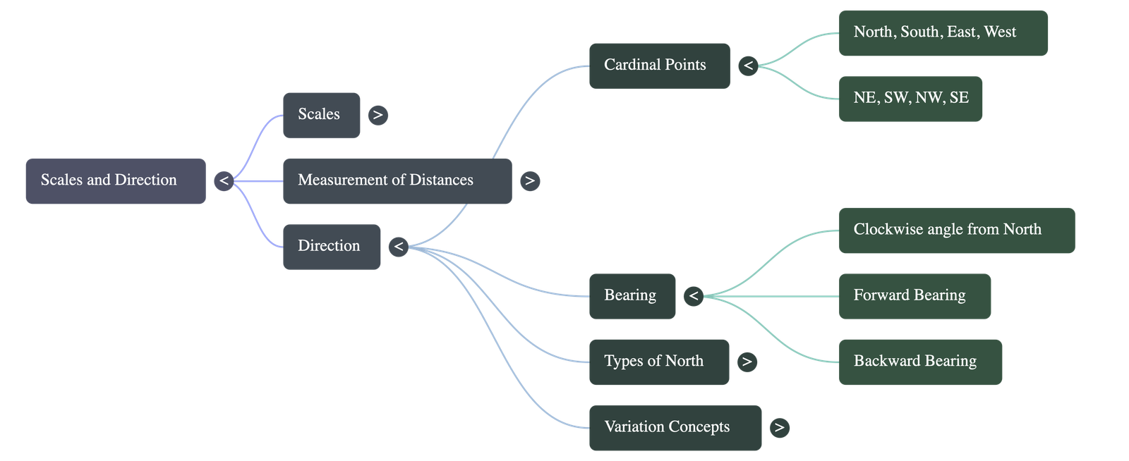
- Four Cardinal Points: North (N), South (S), East (E), and West (W).
- Four Intermediate Directions:
- North-East (NE)
- South-West (SW)
- North-West (NW)
- South-East (SE)
6. Bearing
- Definition: Bearing is a system of angular measurement indicating direction. It is the horizontal angle between the North and the line joining the observer's position to an object, measured in a clockwise direction.
- Forward Bearing (FB): The bearing measured directly from the observer to the object.
- Backward Bearing (BB): The bearing measured from the object back to the observer.
- Relationship: You can calculate one from the other (e.g., if FB is less than 180°, you add 180° to find the BB).
- A bearing calculated with reference to the magnetic north-south line is called a Magnetic Bearing. If calculated with reference to the true (geographic) north-south line, it is a True Bearing.
7. Magnetic North and True North
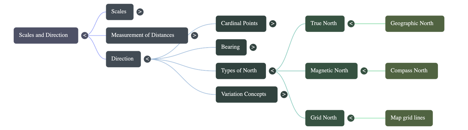
- Magnetic North: The direction in which a magnetic compass needle naturally points.
- True North (Geographic North): The direction towards the geographic North Pole, typically indicated by the North Star. On a globe, all lines of meridian converge at True North.
- Magnetic Declination (or Variation): The angular difference between the true north-south line and the magnetic north-south line.
- Magnetic North is not fixed; it shifts slowly over time, leading to variations in magnetic declination from place to place and time to time.
- Isotonic Lines: Lines drawn on a map that join points experiencing similar variations between the magnetic north and true north.
8. Grid North and Grid Variation
- Grid North: For simplicity on maps, semi-circular lines of longitude are assumed to be drawn as straight, parallel lines. The north direction represented by these straight grid lines is called Grid North.
- Grid Variation: Because the earth is spherical, Grid North slightly differs from True North. This specific variation between Grid North and True North is termed Grid Variation.
End of Chapter Summary - Created for Class 10 Geography Study
Do checkout all questions & answers of this chapter.
Quick Navigation:
| | | |
1 / 1
Quick Navigation:
| | | |