Map Reading and Interpretation
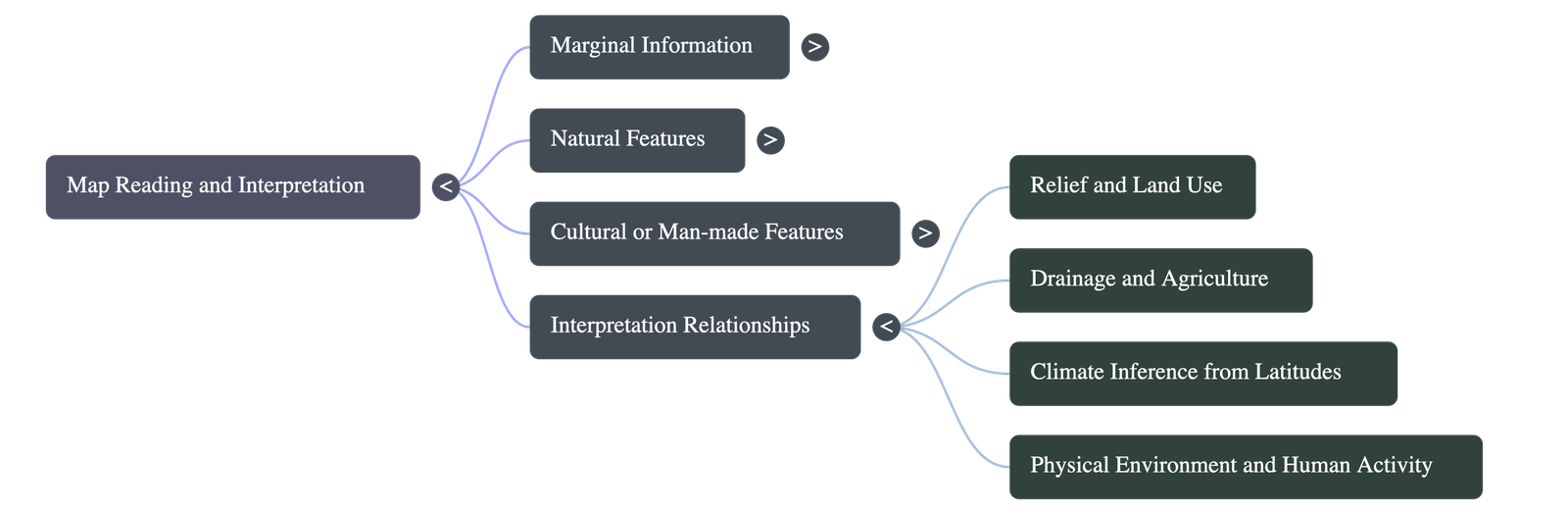
1. Primary or Marginal Information
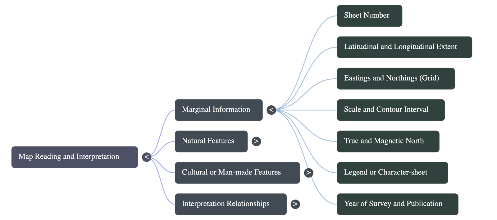
Marginal information refers to the crucial details printed on the margins of a topo-sheet. It includes:
- Number of the sheet: Indicates which specific part of India is depicted (e.g., G43S7).
- Latitudinal and Longitudinal Extent: Degrees of latitude and longitude that help locate the map area.
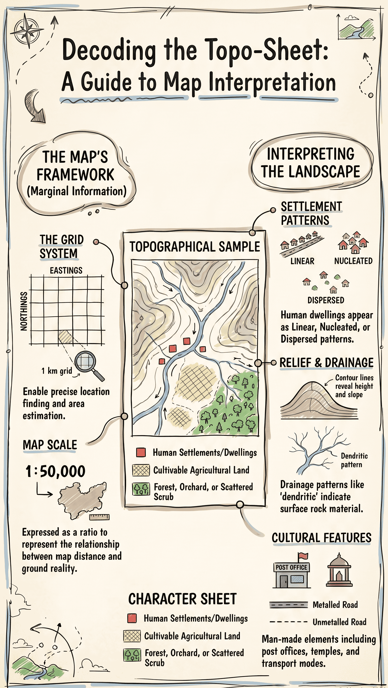
- Eastings and Northings: Two-figure numbers at 1 km intervals forming a grid. They help find exact locations (4-figure/6-figure grids) and estimate area.
- Scale of the Map: Shows the ratio of map distance to ground distance (e.g., 1:50,000).
- Contour Interval: The vertical distance between two consecutive contour lines, depending on the scale and terrain.
- Direction of True North and Magnetic North: Indicated by two arrows on the margin.
- Legend or Character-sheet: A list of standard conventional signs and symbols used on the map.
- Year of Survey and Publication: Printed at the bottom of the topo-sheet.
2. Map Reading Concepts
Map reading involves studying the interrelationship between physical and cultural features:
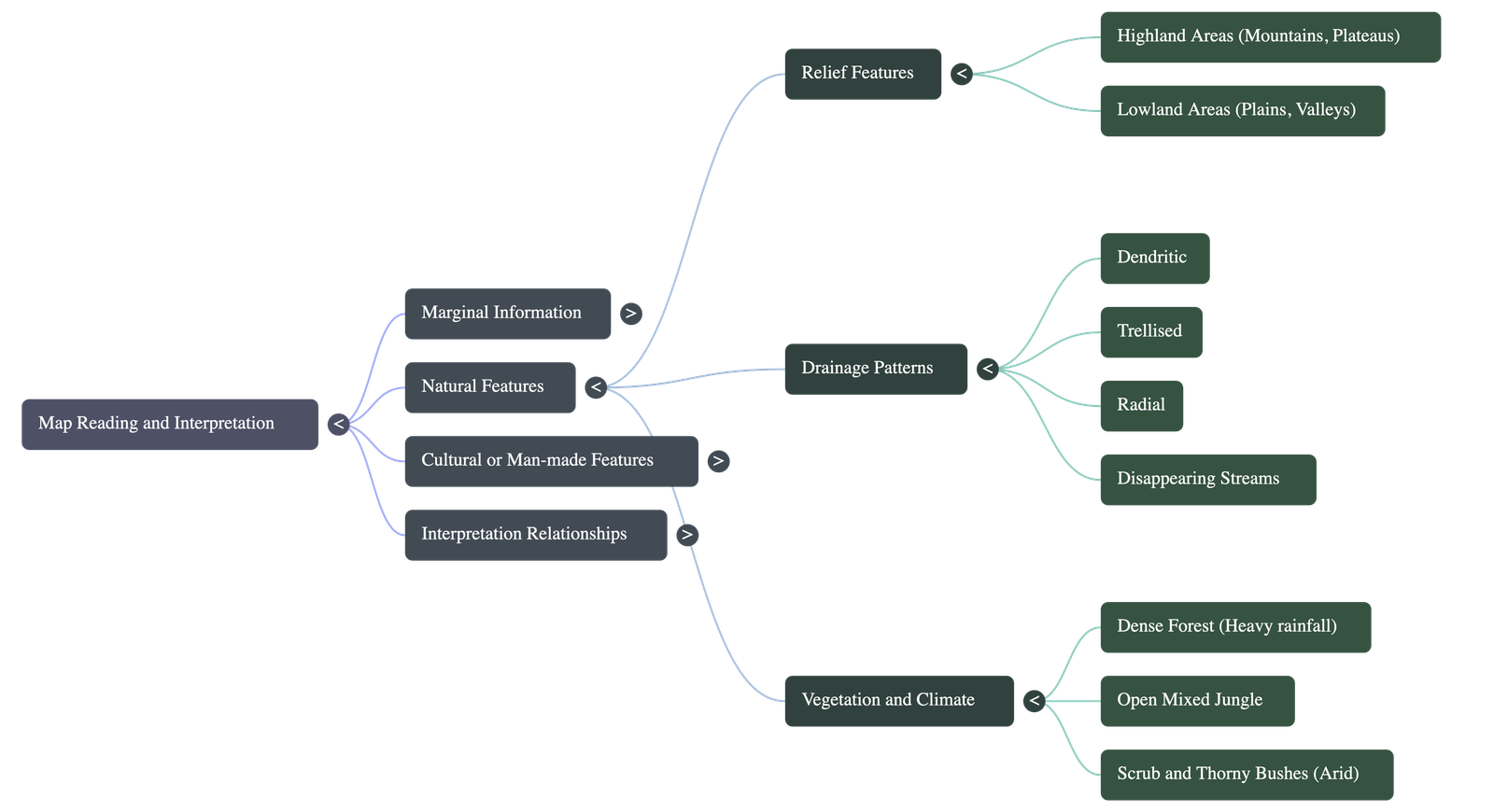
- Natural Features: Topographical maps display mountains, plateaus, rivers, plains, cliffs, and vegetation using contours and specific symbols.
- Man-made (Cultural) Features: Includes houses, roads, railways, temples, wells, and post offices, represented by conventional symbols.
3. Relief Features
Relief refers to the highest and lowest elevations on the map, identified by contour line density:
- Highland Areas: Closely spaced contours denote steep slopes, mountains, or hills. Features like passes, saddles, and flat-topped plateaus can be identified.
- Lowland Areas: Widely spaced or absent contours indicate plains. Factors like slope direction, meandering rivers, and soil types can be observed.
4. Drainage Patterns
Drainage describes how rivers and tributaries flow across the terrain:
- Dendritic Pattern: Tree-like branching; indicates soft surface rock suitable for agriculture.
- Trellised Pattern: Rectangular intersections; indicates the presence of limestone, generally unsuitable for agriculture.
- Radial Pattern: Rivers flowing outward from a central high point (like a hill or mountain peak).
- Disappearing Streams: Streams that vanish into sandy soil; indicates dry regions unsuitable for cultivation.
5. Vegetation and Climate
Topo-sheets don't state climate directly, but it can be inferred from vegetation and latitude:
- Forests: Dense jungles suggest heavy rainfall; deciduous forests are common in moderate climates.
- Scrub and Waste Land: Open scrub, cactus, or thorny bushes suggest arid/semi-arid conditions with poor rainfall (e.g., deserts).
- Latitudinal Extent: Lower latitudes (closer to the equator) generally indicate warmer temperatures than higher latitudes.
6. Relationship Between Physical Features and Human Activities
Physical environments directly control land use, trade, and settlement patterns. Indian topo-sheets typically use Chinese vermilion (red) colour for settlements.
- Highlands: Irregular, tightly packed contours denote steep areas used primarily for grazing, forestry, or sometimes terrace farming.
- Lowlands/Plains: Flat, well-drained areas support mixed farming. Broken ground indicates heavily eroded soft soil due to alternating dry and wet periods.
- Land Use Colour Codes:
- Yellow Wash: Cultivable land (Agriculture).
- Green Wash: Forested areas, orchards, or scrub.
- White/Uncoloured: Barren land, open scrub, or stony waste (used for sheep/goat rearing).
7. Settlements
A settlement is a group of human dwellings, clustered based on geography and resources:
- Thickly Settled: Found in fertile plains and wide river valleys.
- Thinly Settled: Found on plateaus, steep mountain slopes, deserts, and thick forests.
- Types of Settlement Patterns:
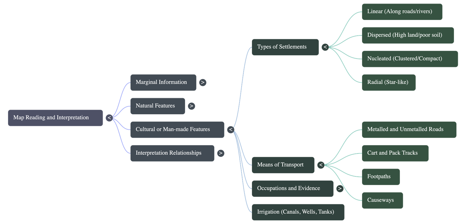
- Linear: Houses built along a road, river, or railway line (Ribbon-patterned).
- Dispersed/Scattered: Isolated farms or houses spread over a wide area, usually indicating poor soil or highland regions.
- Nucleated/Compact: Houses clustered closely together, often around a temple, church, or a fixed water supply.
- Radial: A star-like cluster developing outward from a central point like a factory or lake.
8. Occupations
Occupations are inferred from map symbols and features:
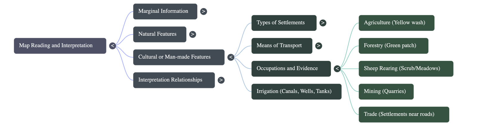
- Agriculture: Indicated by yellow patches, orchards, wells, and canals.
- Forestry: Deduced from green patches or mixed jungles.
- Cattle/Sheep Rearing: Found in areas marked as meadows, open scrub, or stony waste.
- Quarrying and Mining: Shown by the presence of mines, brick kilns, or stone quarries.
- Trade and Commerce: Evidenced by dense road networks, ports, and large settlements.
- Fishery: Implied by coastal areas, rivers, or large lakes.
9. Means of Transport and Communication
Roadways and pathways determine a region's accessibility and economic development:
- Metalled Roads: Hard-surfaced roads (concrete/tar) shown by solid parallel red lines. Indicates developed areas.
- Unmetalled Roads: Dirt/mud roads ("Kutcha" roads) shown by dotted parallel red lines.
- Cart Tracks: Continuous single red lines showing rough paths for animal carts.
- Pack Tracks: Broken single red lines for pack animals or people.
- Footpaths: Dashed or dotted green lines for pedestrians in fields or forests.
10. Analysis of Topo-sheets (Practical Application)
The chapter includes detailed practical analyses of specific map extracts (like G43S7 and G43S10) representing the Rajasthan and Gujarat borders:
- Physical Regions Analyzed: Rocky highlands (Aravalli hills, Mt. Abu), lowland plains (piedmont zones), and saline deserts.
- Drainage Studies: Rivers like Banas, Sipu Nadi, and Balaram Nadi, noting seasonal water flow, dry beds, and dams.
- Climatic Observations: Continental climate featuring extreme heat, poor rainfall, and reliance on wells/tanks for irrigation.
- Settlement Studies: Identifying specific towns like Dantiwada and Abu, determining their roles as agricultural hubs, administrative centers, or tourist destinations.
Do checkout all questions & answers of this chapter.