Quick Navigation:
| | | | |
Quick Navigation:
| | | | |
India: Location, Political Divisions and Physical Features
Point-wise summary of Chapter 8, which details India's geographical location, political structure, and physical landscape:
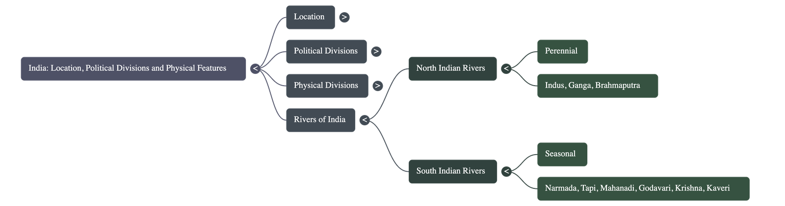
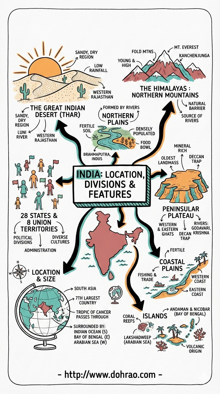
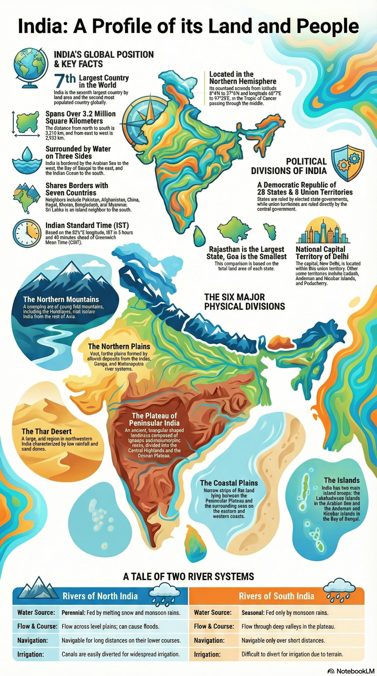
Location and Political Divisions
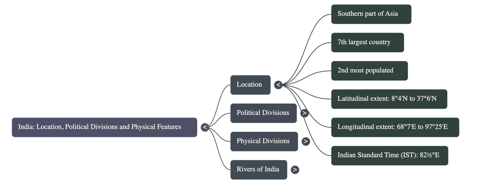
- Geographic Setting: India is located in southern Asia and is the seventh largest and second most populated country in the world. It lies entirely in the Northern Hemisphere.
- Boundaries: It is bordered by the Himalayan mountain ranges to the north, the Arabian Sea to the west, the Bay of Bengal to the east, and the Indian Ocean to the south.
- Neighboring Countries: India shares borders with Pakistan, Afghanistan, China, Nepal, Bhutan, Bangladesh, and Myanmar, while Sri Lanka lies to the south across the Palk Strait.
- Indian Standard Time (IST): Due to a 30° longitudinal difference between the east and west, there is a two-hour time difference across the country. To ensure uniformity, the 82 ½°E longitude is used as the Central Meridian for IST, which is 5 ½ hours ahead of Greenwich Mean Time (GMT).
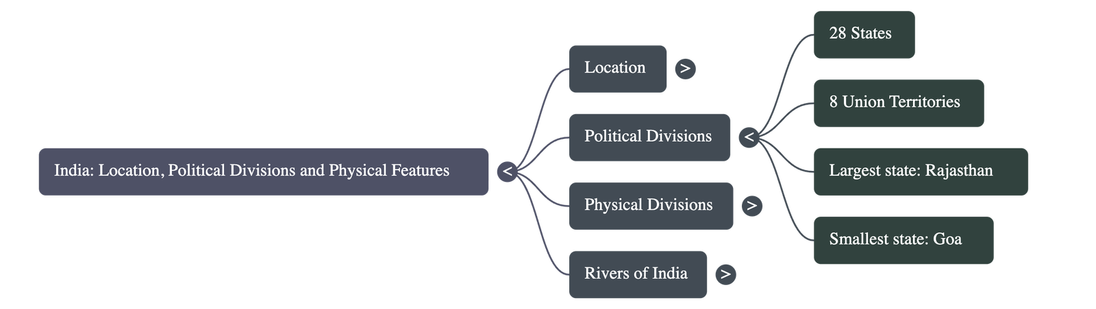
- Administrative Structure: The country is a Democratic Republic consisting of 28 states and 8 union territories. Rajasthan is the largest state by area, while Goa is the smallest.
Physical Regions of India
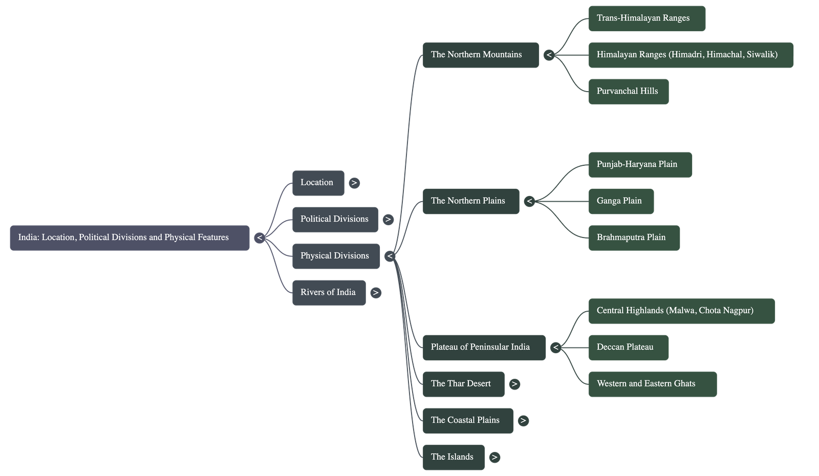
The sources divide India into six major physical regions:
- The Northern Mountains: These include the Himalayas, which are divided into three parallel ranges: the Himadri (Greater Himalayas), the Himachal (Lesser Himalayas), and the Siwaliks (Outer Himalayas). They serve as a natural barrier, influence the climate by blocking monsoon winds, and are the source of perennial rivers like the Ganga.
- The Northern Plains: Also known as the Indo-Gangetic Plains, these were built by rich alluvium deposited by the Indus, Ganga, and Brahmaputra rivers. This region is highly fertile, making it one of the most densely populated areas in the world.
- The Plateau of Peninsular India: The largest physical division, it is triangular and composed of ancient igneous and metamorphic rocks. It includes the Central Highlands and the Deccan Plateau. The Deccan Plateau is characterized by volcanic "Deccan Traps" that produced fertile black soil.
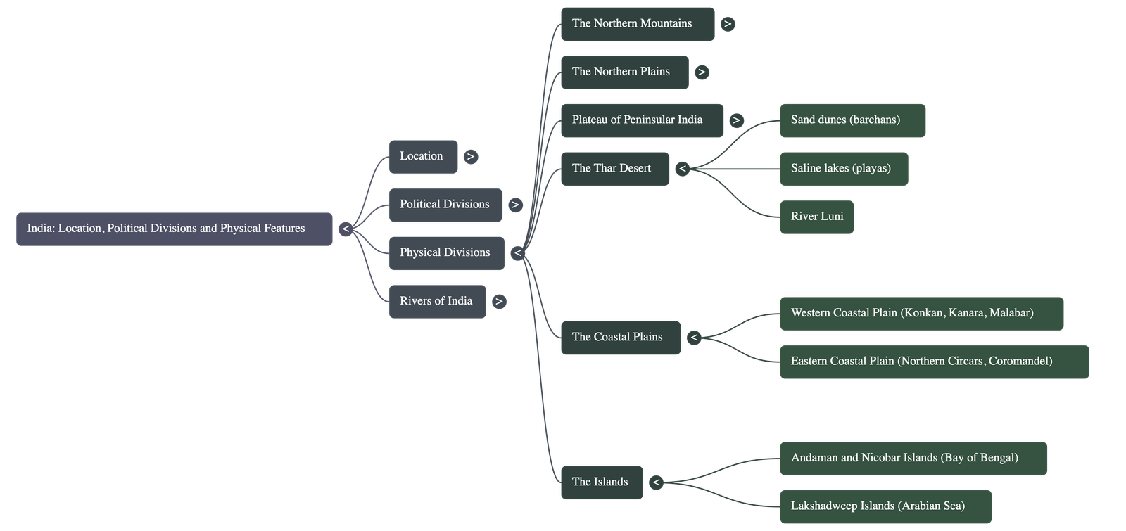
- The Thar Desert: Located in northwestern India, this arid region features sand dunes (barchans) and shallow salt lakes called playas. Its aridity is caused by irregular rainfall and the Aravalli Range lying parallel to monsoon winds.
- The Coastal Plains: These lie between the Ghats and the sea. The Western Coastal Plain is narrow and features the backwaters of Kerala, while the Eastern Coastal Plain is broader and contains fertile deltas formed by rivers like the Godavari and Krishna.
- The Islands: India has two main groups: the Andaman and Nicobar Islands in the Bay of Bengal (peaks of a submarine mountain chain) and the Lakshadweep Islands in the Arabian Sea (coral in origin).
Rivers of India
- North Indian Rivers: These rivers, such as the Indus, Ganga, and Brahmaputra, are perennial, meaning they have water throughout the year because they are fed by melting snow and monsoon rain.
- South Indian Rivers: Rivers like the Godavari, Krishna, and Kaveri are seasonal, depending primarily on monsoon rains, and may run dry during summer months.
- River Flow: Most major rivers flow eastward into the Bay of Bengal, forming deltas; however, the Narmada and Tapi are the two major rivers that flow westward into the Arabian Sea through rift valleys.
Analogy for Understanding: To visualize India’s geography, imagine a grand fortress: the Himalayas are the high, protective northern walls; the Northern Plains are the lush, central courtyard where everyone gathers to eat; the Peninsular Plateau is the ancient, raised stone foundation; and the Coastal Plains are the scenic balconies overlooking the surrounding moats of the Arabian Sea and Bay of Bengal.
Quick Navigation:
| | | | |
1 / 1
Quick Navigation:
| | | | |