Quick Navigation:
| | | | |
Quick Navigation:
| | | | |
Asia: Location, Political Divisions and Physical Features
Point-wise summary of Chapter 6: Asia: Location, Political Divisions and Physical Features:
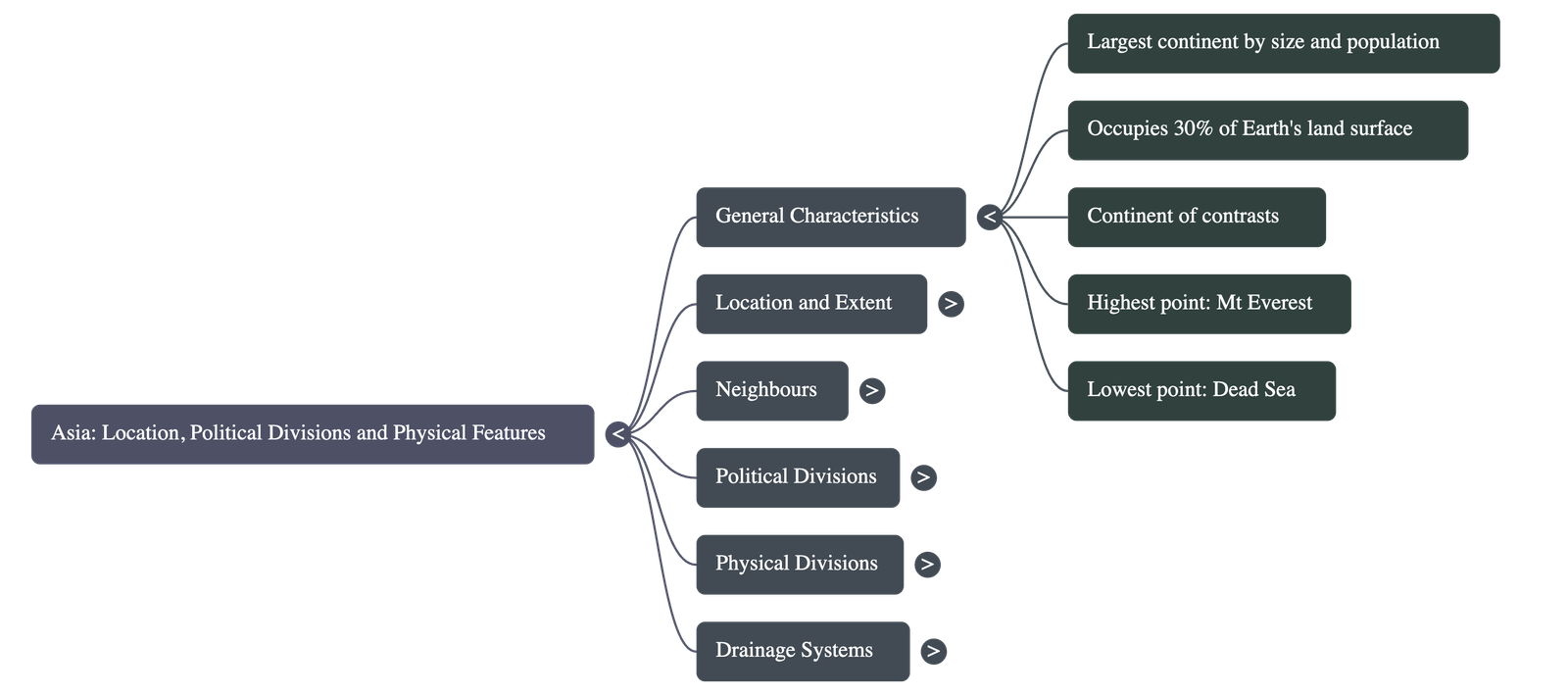
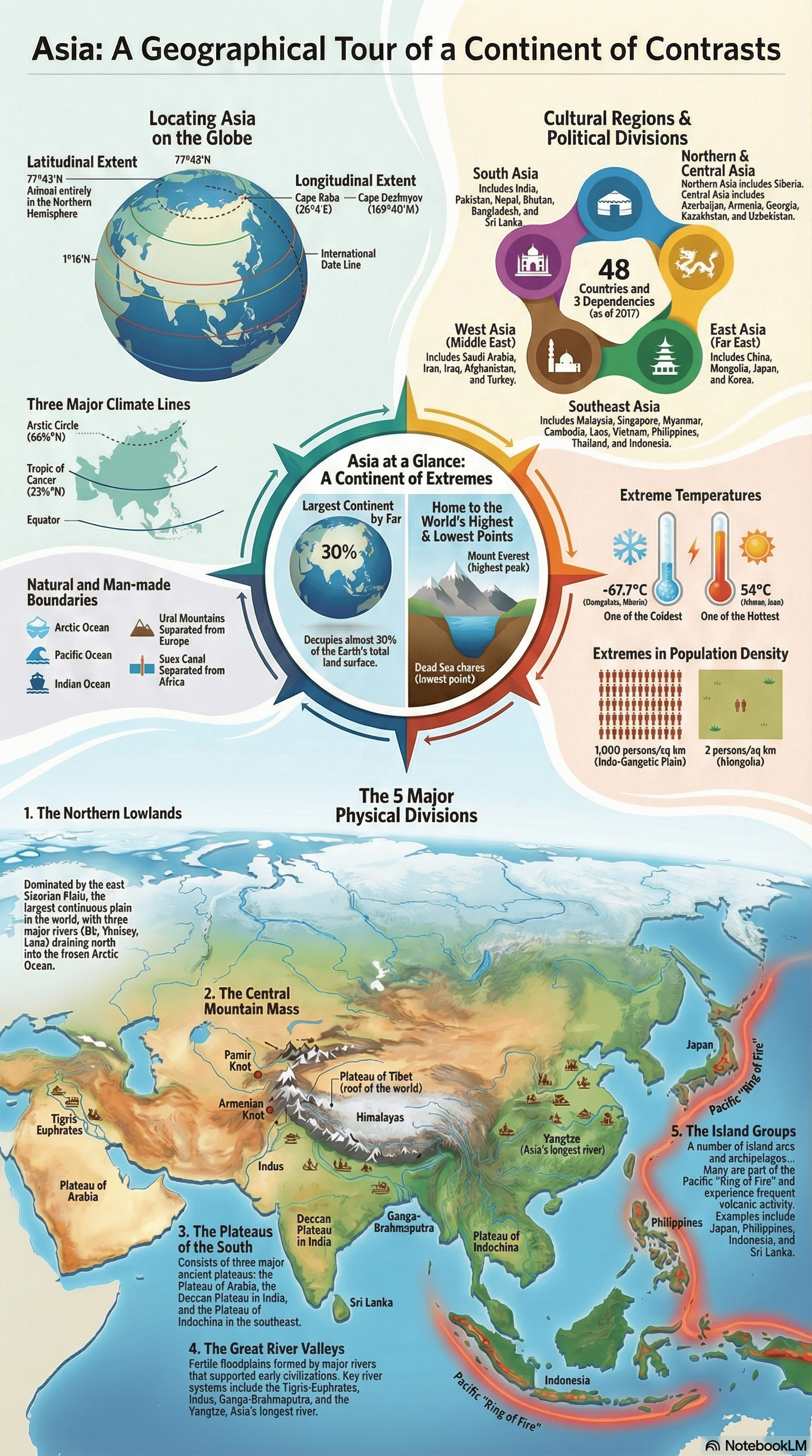
Overview: A Continent of Contrasts
- Size and Population: Asia is the largest continent, occupying nearly 30% of the Earth's land surface and housing the world's largest population.
- Diverse Extremes: It is called a "continent of contrasts" because it contains the world’s highest peak (Mt. Everest) and lowest point (Dead Sea), the wettest places (Mawsynram and Cherrapunji) alongside vast deserts (Gobi and Thar), and extremes in temperature ranging from $-67.7^\circ\text{C}$ to $54^\circ\text{C}$.
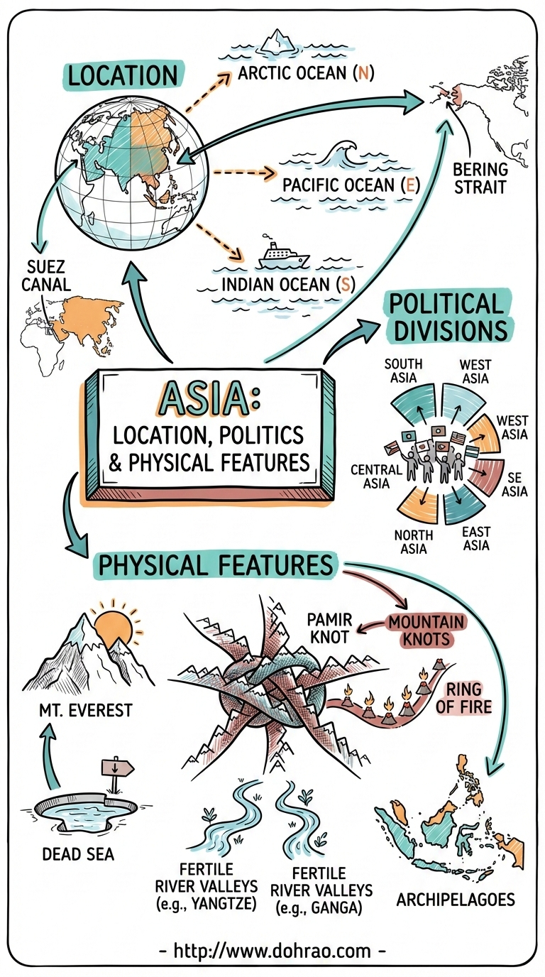
Location and Neighbors
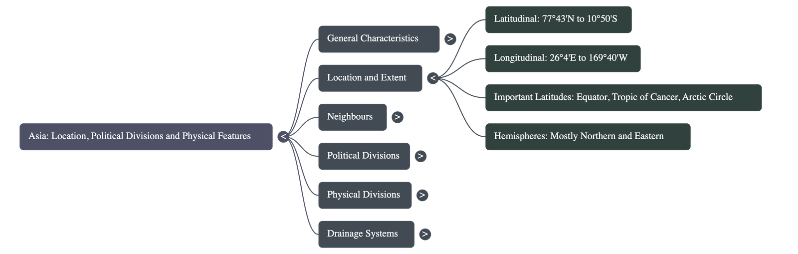
- Hemispheres: Asia is situated almost entirely in the Northern and Eastern Hemispheres, with only some Indonesian islands extending south of the Equator.
- Latitudinal and Longitudinal Extent: It stretches across all heat zones, from the Arctic Circle in the north to the Equator in the south. It extends longitudinally from Turkey in the west to the Bering Strait in the east.
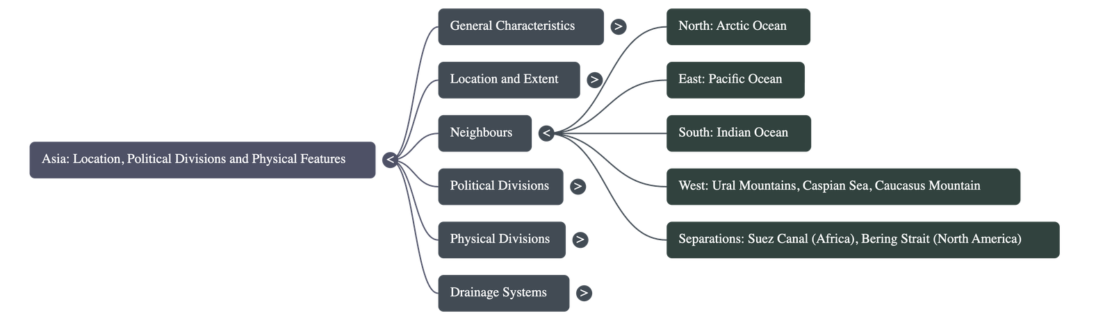
- Boundaries:
- North: Arctic Ocean.
- East: Pacific Ocean.
- South: Indian Ocean.
- West: It is separated from Europe by the Ural Mountains, Ural River, Caspian Sea, Caucasus Mountains, Black Sea, and Red Sea.
- Africa and North America: Separated from Africa by the Suez Canal and from North America by the Bering Strait.
Political Divisions
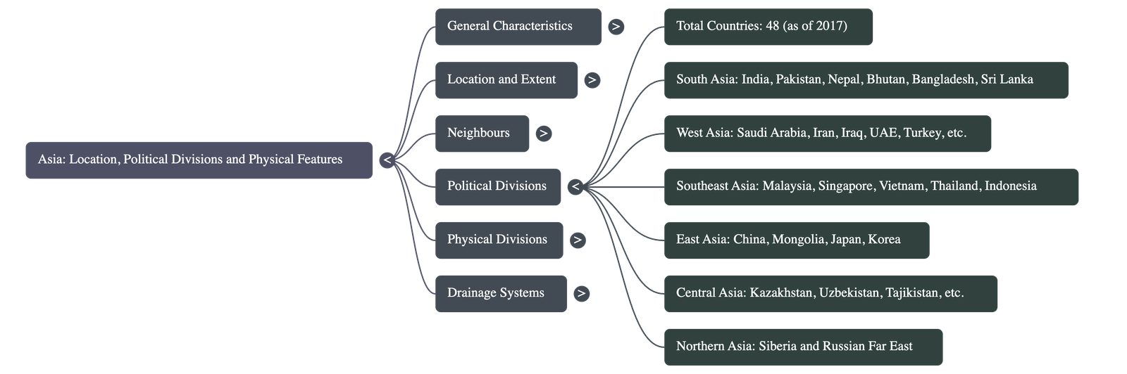
- Countries: As of 2017, the United Nations recognized 48 countries in Asia and three dependencies: Taiwan, Hong Kong, and Macau.
- Regional Groups: To simplify study, the continent is divided into six regions: South Asia, West Asia (often called the Middle East), Southeast Asia, East Asia (the Far East), Northern Asia, and Central Asia.
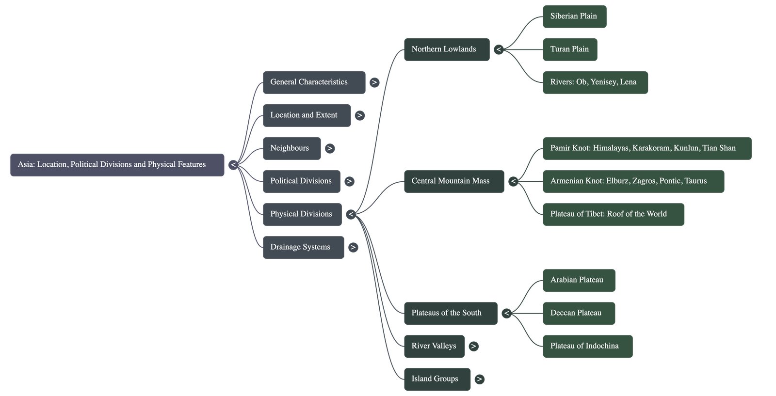
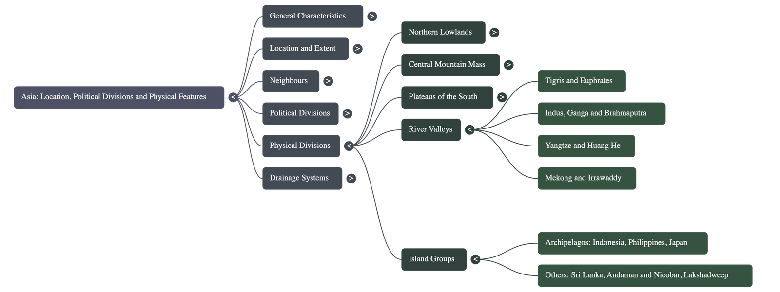
Physical Divisions
Asia is divided into five primary physical regions based on relief:
- The Northern Lowlands: This region includes the Siberian Plain, the largest continuous plain in the world, and the arid Turan Plain.
- The Central Mountain Mass: This "heart" of Asia features young fold mountains and intermontane plateaus (plateaus between mountain ranges). Most mountain ranges radiate from two central "knots": the Pamir Knot and the Armenian Knot. It includes the Plateau of Tibet, known as the "roof of the world" because it is the highest plateau globally.
- The Plateaus of the South: Includes the Arabian Plateau, the volcanic Deccan Plateau in India, and the Plateau of Indochina.
- The River Valleys: Home to some of the world's most fertile and densely populated regions, these valleys were built by major rivers like the Tigris, Euphrates, Indus, Ganga, Brahmaputra, Yangtze (the longest in Asia), and Huang He.
- The Island Groups: Asia features numerous archipelagos (groups of islands), including Indonesia, the Philippines, and Japan. Many are volcanic peaks located in the Pacific Ring of Fire, making them prone to earthquakes.
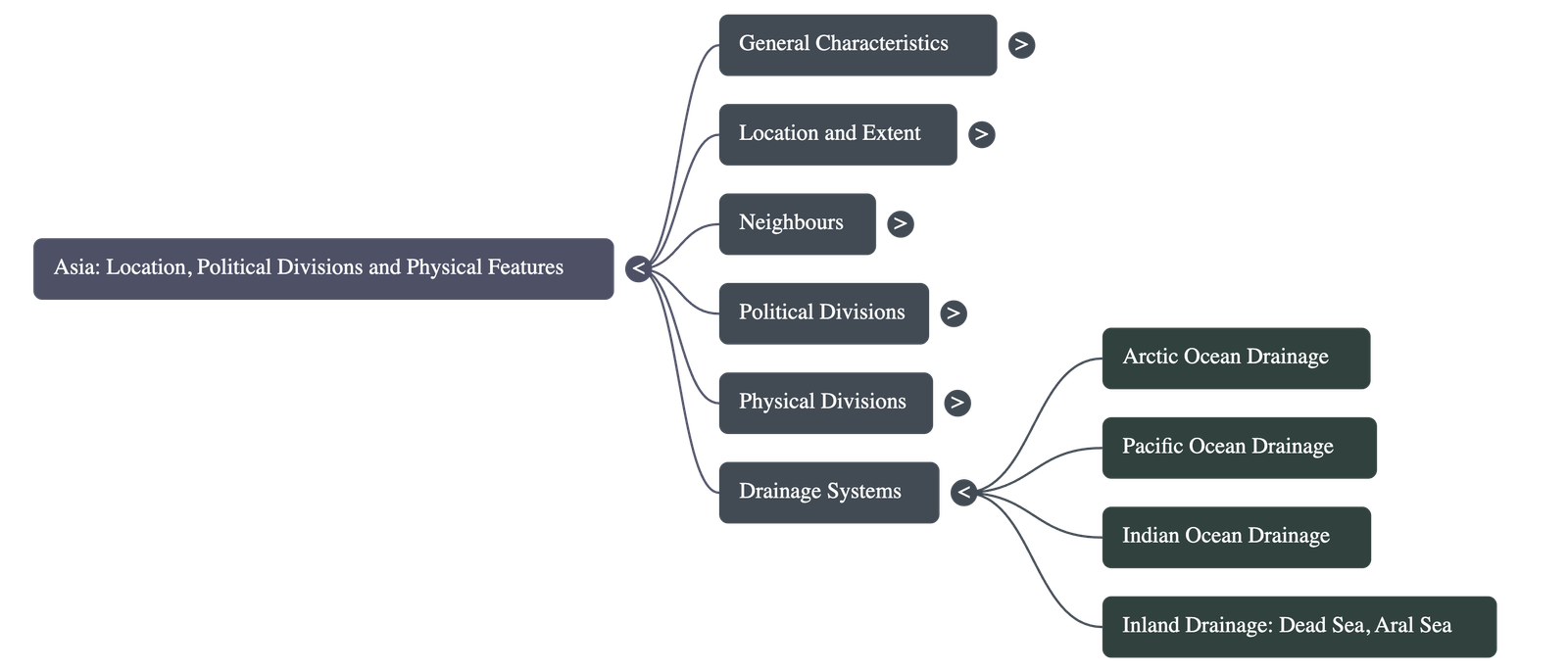
Drainage Systems
- Oceanic Drainage: Rivers are categorized by the oceans they flow into: the Arctic Ocean (Ob, Yenisey, Lena), the Pacific Ocean (Yangtze, Mekong), and the Indian Ocean (Indus, Ganga).
- Inland Drainage: Some rivers do not reach the sea but flow into inland lakes or seas, such as the Amu Darya and Syr Darya, which flow into the Aral Sea.
Analogy: You can think of Asia as the world’s most complex puzzle. Its "knots" (the Pamir and Armenian) act as the center pieces from which the mountain "edges" radiate outward, while its massive river valleys serve as the colorful, life-filled sections that connect different regions of the board.
Questions and Answers
Section A: Fill in the Blanks
-
1. ________ is the highest peak in the world, while the ________ is the lowest point on the surface of the Earth.Answer: Mt Everest; Dead Sea
-
2. The wettest places on Earth are ________ and ________ in India.Answer: Mawsynram; Cherrapunji
-
3. The Suez Canal separates Asia from ________.Answer: Africa
-
4. The Himalayas run into Myanmar as the ________.Answer: Arakan Yoma
-
5. The ________ is a depression that lies between the Tian Shan in the north and the Kunlun to the south.Answer: Tarim Basin
-
6. The ________ and ________ rivers make up the plains of Indochina.Answer: Maenam (Chao Phraya); Mekong
-
7. The Ob, Yenisey and Lena rivers drain into the ________.Answer: Arctic Ocean
Section B: True or False (with Corrections)
-
1. Most of Asia lies in the Northern and Western hemispheres.Answer: False. Most of Asia lies in the Northern and Eastern hemispheres.
-
2. The Equator is the only major latitude that passes through Asia.Answer: False. Three important lines of latitude pass through Asia—the Equator, the Tropic of Cancer, and the Arctic Circle.
-
3. The Bering Strait separates Asia from Europe.Answer: False. The Bering Strait separates Asia from North America. (Asia is separated from Europe by the Ural Mountains, etc.)
-
4. The Himalayas radiate from the Armenian Knot.Answer: False. The Himalayas radiate from the Pamir Knot.
-
5. Singapore and Hong Kong are islands.Answer: True.
Section C: Multiple Choice Questions
1. This is one of the least densely populated regions in the world:
a) Indochina
b) the Deccan Plateau
c) Mongolia
d) Tibet
Answer: c) Mongolia
Section D: Recalled Questions (Interspersed in Text)
1. Do you remember what intermontane plateaus are?
Answer: Intermontane plateaus are plateaus that lie between two mountain ranges.
Quick Navigation:
| | | | |
1 / 1
Quick Navigation:
| | | | |